
Mountain type Volcanic Elevation 1,168 m | ||
 | ||
Similar Mount Cordeaux, Spicers Peak, Wilsons Peak, Mount Greville, Mount Edwards | ||
Mount Mitchell (Aboriginal: Cooyinnirra), is a twin-peaked volcanic mountain with an elevation above sea level of 1,168 metres (3,832 ft), located in the Main Range, is about 100 kilometres (62 mi) west of Brisbane, Queensland, Australia and immediately south of Cunninghams Gap.
Contents
Map of Mount Mitchell, Tregony QLD 4370, Australia
Features and history
The peak to the south of the gap was named by Allan Cunningham in 1828 and today is part of the Main Range National Park. Cunningham named the mountain after the Surveyor-General, Thomas Mitchell.
To the north of Cunninghams Gap is Mount Cordeaux, while Spicers Peak is located a small distance to the south east.
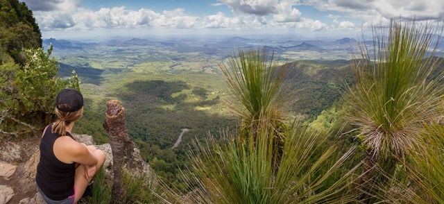
A trail, classified as grade 4, winds 5.1 kilometres (3.2 mi) up to the main summit which offers some great views. From the peak on a clear day the tallest buildings in Brisbane can be seen, as can the D'Aguilar Range, Teviot Range, Fassifern Valley and many other parts of the Scenic Rim. At the top of mountain there are sheer cliff edges.