
Elevation 2,545 m | Topo map NTS 83C/01 Prominence 564 m | |
 | ||
Similar Sunwapta Peak, Sentinel Peak, Mount Saskatchewan, Mount Cline, Howse Peak | ||
Mount michener alberta
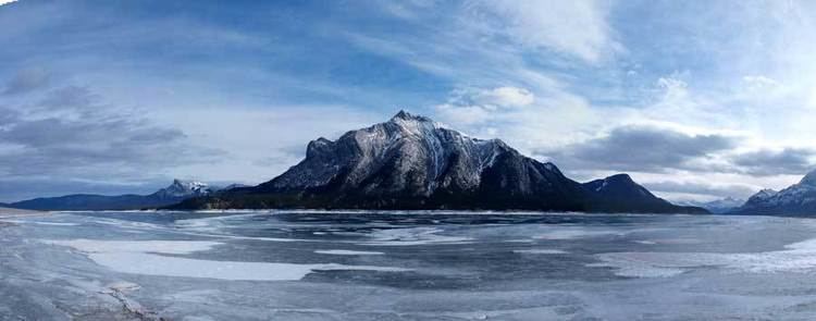
Mount Michener, with a 2,545 m (8,350 ft) peak, is a mountain on the eastern border of the Canadian Rockies in Alberta, Canada. It forms the northerly part of the Ram Range.
Contents
- Mount michener alberta
- Map of Mount Michener Clearwater County AB Canada
- Mount michener summit 2015
- Geography
- References
Map of Mount Michener, Clearwater County, AB, Canada
The mountain sits on the shore of Abraham Lake and its north, west and south face are all visible from the David Thompson Highway.
The mountain was named in 1982 after Daniel Roland Michener who was the Governor General of Canada from 1967 - 1974. Its previous names were Eye Opener Mountain and Phoebe's Teat, reportedly after a woman from Rocky Mountain House who would periodically visit the Nordegg miners in the 1930s.
Mount michener summit 2015
Geography
The formation of the Rocky Mountains began in the Late Cretaceous Period and finished in the Early Tertiary Period. The pressure on the fault line caused thousands of metres of rock to thrust upward. The contorted beds near the summit of Mount Michener are visible evidence of the tremendous force that caused its formation. A system of limestone caves does exist within the mountain, but they remain undocumented.