
Population 17,087 (2011) Area 17.2 km² | Postcode(s) 3934 Postal code 3934 | |
 | ||
LGA(s) Shire of Mornington Peninsula | ||
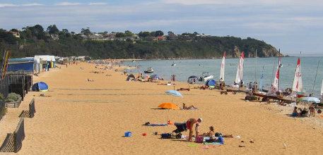
Mount Martha is a seaside town in Melbourne, Victoria, Australia 60 kilometres (37 mi) south-east of Melbourne's central business district. Its local government area is the Shire of Mornington Peninsula. It is on the south-eastern shores of Port Phillip and offers a bathing beach. A boardwalk winds its way for more than 5 kilometres (3 mi) along the Balcombe Creek, its North beach mouth to the Briars Historic Park. The suburb's highest point bears the area's name and reaches 160 metres (520 ft). The peak was named after Martha Lonsdale, the wife of the colonist William Lonsdale.
Contents
Map of Mount Martha VIC 3934, Australia
It marks the start of the Selwyn fault, a geological formation which runs to the eastern Dandenong Ranges.
History
Mount Martha has its roots dating back to the 1840s when the township's major role was that of farming. The Briars Homestead in the town's east was constructed from 1848 to 1851 and was used by Alexander Balcombe until 1876 as he farmed the land surrounding it and tended to 100 acres (0.40 km2) of vineyards. The homestead was named after the lodging of the same name in Saint Helena. Dame Mabel Brookes collected Napoleonic memorabilia which was also donated to the Mornington Peninsula shire; some is on display at the house.
In 1891, the Martha Hotel, designed by architects Tappin, Gilbert and Dennehy was constructed in a Federation Queen Anne style. Today, the building now known as Mt. Martha House serves as a community centre and is Victorian Heritage listed. As the population grew, Mount Martha Post Office opened around 1902.
During the Second World War, Mount Martha's Balcombe Creek camp hosted the United States Marine Corps's 1st Marine Division in late 1942 following their involvement in the Battle of Guadalcanal. After the conclusion of the war, it was progressively relocated or demolished until 1999. The area is now known as Balcombe Estuary and has barbecue facilities (including an open fireplace) as well as a children's play area in the west, and residential allocations were made in the east. Also during the Second World War, Mount Martha House had extensive use by the military and functioned as a Women's Royal Australian Army Corps (WRAAC) barracks up until 1978.
In 1978, a water treatment plant was constructed in the town's east. It services the nearby towns of Mornington, Mount Eliza, Mount Martha, Somerville, Pearcedale and Baxter, and provides treated water to local vineyards, a tree plantation and lawns.
Today
More recently from the 1990s to the present the Mount Martha area has experienced significant population growth particularly in the south with the Martha Cove marina development as well as east towards the Moorooduc Highway.
Mount Martha is home to a volunteer CFA fire brigade responding on average to 180 calls a year for assistance from the community. Incidents range from grass and scrub fires, motor vehicle accidents, to house fires.
Mount Martha Surf Lifesaving Club holds the popular annual Mount Martha Australia Day Swim, the "MMAD Swim". Golfers play at the course of the Mount Martha Golf Club on Forest Drive. Mount Martha is also home to public tennis courts, four football ovals and numerous grass reserves.
Bird Rock Beach, named from a basalt rock offshore, is a popular running and training place.
Transport
Peninsula Link and the Mornington Peninsula Freeway are both major arterial routes to both Mount Martha and the Mornington Peninsula, from Melbourne (via the EastLink tollway).