
Topo map USGS Mount Katmai A-4 Last eruption 500 BCE ± 50 years Prominence 1,400 m Volcanic arc Aleutian Arc | Elevation 2,165 m Mountain range Aleutian Range Parent range Aleutian Range | |
 | ||
Similar Trident Volcano, Mount Griggs, Ugashik‑Peulik, Mount Martin, Mount Chiginagak | ||
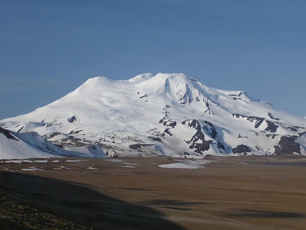
Mount Mageik /məˈɡiːk/ is a stratovolcano on the Alaska Peninsula. It has no confirmed historical eruptions (one in 1946 is now deemed questionable), but its youngest eruptive products are apparently Holocene in age (8750 to 500 BCE). A young crater lies on the northeast flank of the central summit cone, and is the site of vigorous superheated fumarolic activity with prominent sulfur deposits. The volcanic cones are composed of andesite, basaltic andesite and dacite.
Map of Mt Mageik, Alaska, USA
The volcano is mantled in ash from the 1912 eruption of Novarupta and from the 1953 eruption of nearby Trident Volcano.
References
Mount Mageik Wikipedia(Text) CC BY-SA