
Volcanic arc/belt Aleutian Arc Elevation 2,317 m Mountain range Aleutian Range | Last eruption 1790 BCE ± 40 years Prominence 2,225 m Parent range Aleutian Range | |
 | ||
Listing North America prominent 60thNorth America isolated 91st Similar Mount Chiginagak, Mount Mageik, Mount Douglas, Korovin Volcano, Mount Vsevidof | ||
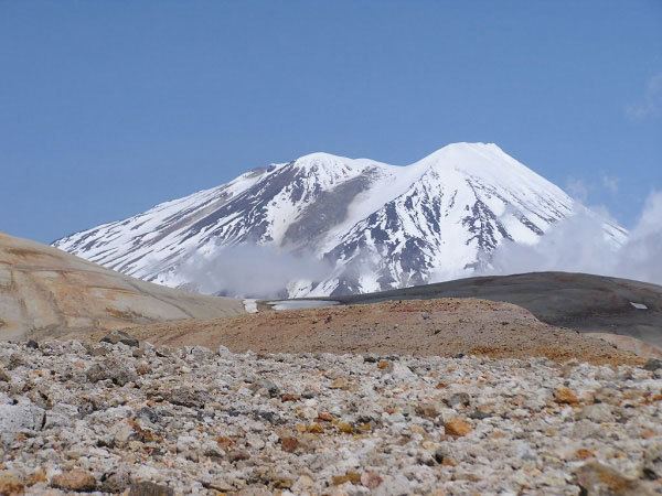
Mount Griggs, formerly known as Knife Peak Volcano, is a stratovolcano, which lies 10 km behind the volcanic arc defined by other Katmai group volcanoes. Although no historic eruptions have been reported from Mount Griggs, vigorously active fumaroles persist in a summit crater and along the upper southwest flank. The fumaroles on the southwest flank are the hottest, and some of the flank fumaroles can roar so loudly that they can be heard from the valley floor. The slopes of Mount Griggs are heavily mantled by fallout from the 1912 eruption of Novarupta volcano.
Map of Mt Griggs, Alaska, USA
The mountain was named for Dr. Robert Fiske Griggs (1881–1962), botanist, whose explorations of the area, after the eruption of Mount Katmai in 1912, led to the creation of Katmai National Monument by President Woodrow Wilson in 1918.