
OS grid NO409869 Prominence 314 m | Elevation 939 m Mountain range Grampian Mountains | |
 | ||
Similar Driesh, Lochnagar, Broad Cairn, Glas Maol, Cairn of Claise | ||
A hike up mount keen and wild camping by the river tanar
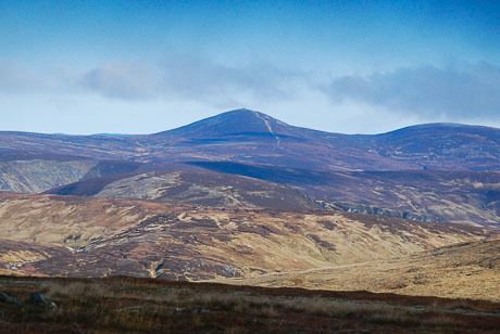
Mount Keen (Scottish Gaelic: Monadh Caoin, [ˈmɔnəɣ kʰɯːɲ]) is a 939 m (3,081 feet) high mountain in Scotland and the most easterly Munro. It can be accessed from several directions, South from Glen Mark, North from Glen Tanar, and East to Braid Cairn. It is a moderate walk which is most popularly started by mountain bike, riding through the native Caledonian pine forest of Glen Tanar from Aboyne. On a good day, the Cairngorms, especially Lochnagar, can be seen. The summit is marked by a trig point.
Contents
- A hike up mount keen and wild camping by the river tanar
- Map of Mount Keen Aboyne UK
- Tgo challenge 2010 view from mount keen
- Path qualityEdit
- SummitEdit
- References
Map of Mount Keen, Aboyne, UK
Tgo challenge 2010 view from mount keen
Path qualityEdit
Path quality is very good on the approach to the mountain. There is a wide forestry track most of the way to the foot of the mountain if approaching from Aboyne and Glen Tanar. Path quality on the mountain itself is moderate. An effort has been made to widen and ensure the path remains water free, however rain has left some shallow channels in the path. Further up, the path becomes rocky yet easy to walk on unless in icy conditions.
SummitEdit
Mobile phone reception is excellent from the summit for Vodafone and O2 users and possibly many others as there is a direct line of sight with the Durris mast. There is a steep drop to the East of the summit so in icy conditions care should be taken. Limited shelter can be taken beside large boulders and a trig point allows walkers to collect their bearings.
In 2002 the footbridge at the base of Mount Keen on the Glen Tanar side was washed away. To allow for improved access to this popular Munro the bridge has been replaced.