
Topo map OS Landranger 43 Prominence 194 m | OS grid NO167765 Elevation 1,068 m | |
 | ||
Translation Grey-green hill (Gaelic) Pronunciation Scottish Gaelic: [ˈklˠ̪as̪ ˈmɯːlˠ̪] Similar Cairn of Claise, The Cairnwell, Càrn Aosda, Broad Cairn, Lochnagar | ||
Glas Maol is the highest point in the Mounth hills, in the southeastern part of the Highlands of Scotland. The broad, flat summit is divided between the council area of Aberdeenshire, Angus and Perth and Kinross, though the highest point lies wholly within Angus; indeed Glas Maol is the highest point in that council area.
Map of Glas Maol, Blairgowrie, UK
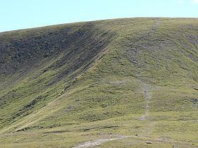
The western slopes of Glas Maol form part of the Glenshee Ski Centre ski area. The most common route of ascent goes through the slopes, starting from the highest point of the A93 road, the Cairnwell pass. This is the highest public road in Scotland; hence only around 400 m of ascent is involved.
Glas Maol is often climbed in conjunction with Creag Leacach to the south or Cairn of Claise to the north. The broad ridge linking these peaks is topped by a Dry-stone dyke, which approximately corresponds to the border of the Angus council area.