
Parent range Rokko Mountains Range Mount Rokkō | Elevation 309 m | |
 | ||
Pronunciation Japanese: [kaꜜbutojamaꜜ] Mountain type A monadnock of an old volcano Similar Mount Rokkō, Gorogorodake, Mount Maya, Azumaotafukuyama, Mount Iwakura | ||
Climbing mount kabuto saturday school part 1
Mount Kabuto (甲山, Kabuto-yama) is a mountain in Nishinomiya, Hyōgo, Japan. It is located in the east end of the Rokko Mountains, and the height is 309.2m.
Contents
- Climbing mount kabuto saturday school part 1
- Map of Mount Kabuto Kabutoyamacho Nishinomiya HyC58Dgo 662 0001 Japan
- January 3rd 2015 kanno ji and mt kabuto
- Outline
- History
- Access
- References
Map of Mount Kabuto, Kabutoyamacho, Nishinomiya, Hy%C5%8Dgo 662-0001, Japan
January 3rd 2015 kanno ji and mt kabuto
Outline
Mount Kabuto is a famous picnic spot in the Kansai metropolitan area. It is a monadnock of an extinct volcano that was last estimated to have erupted about 12,000,000 years ago. This mountain is in the Kabutoyama Forest Park.
History
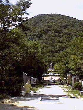
The mountain is shaped like a helmet, 'kabuto' in Japanese. It has a long history as an object of worship by people around the mountain. Kanno-ji in the middle of the mountain is the place of worship of the mountain.
According to Japanese myth, it is understood that because Empress Jingū buried her helmet when she went to subjugate Silla, a dynasty in the Korean Peninsula, this mountain was named 'Kabutoyama', literally "helmet mountain."