
Topo map USGS Stairs Mountain Prominence 62 m | Elevation 1,220 m | |
 | ||
Similar Mount Eisenhower, Mount Tom, Owl's Head, Mount Waumbek, Mount Tecumseh | ||
Mount isolation nh 4 000 footer 46
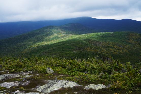
Mount Isolation is a mountain located in Coos County, New Hampshire. The mountain is part of the Presidential Range of the White Mountains. Mt. Isolation is the highest peak on the Montalban Ridge which extends south from Boott Spur.
Contents
- Mount isolation nh 4 000 footer 46
- Map of Mt Isolation Sargents Purchase NH 03846 USA
- Mount isolation winter bushwhack march 2016
- References
Map of Mt Isolation, Sargent's Purchase, NH 03846, USA
Isolation is in the Presidential Range–Dry River Wilderness, and as its name implies, is one of the most remote White Mountain peaks. Isolation just qualifies as one of the Appalachian Mountain Club's "Four-thousand footers", having the requisite 4,000 feet (1,219 m) of elevation and 200 feet (61 m) of prominence.
Mount isolation winter bushwhack march 2016
References
Mount Isolation Wikipedia(Text) CC BY-SA