
Easiest route rock/snow/ice climb First ascent 1964 Mountain range Alaska Range | Topo map USGS Talkeetna D-2 Elevation 3,731 m Prominence 881 m | |
 | ||
Similar Mount Hunter, The Moose's Tooth, Mount Foraker, Mount Dickey, Mount Silverthrone | ||
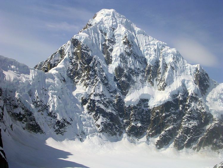
Mount Huntington is a striking rock and ice pyramid in the central Alaska Range, about 8 miles (13 km) south-southeast of Denali. It is also about 6 miles (10 km) east of Mount Hunter. While overshadowed in absolute elevation by Denali, Huntington is a steeper peak: in almost every direction, faces drop over 5,000 feet (1,520 m) in about a mile (1.6 km). Even its easiest route presents significantly more technical challenge than the standard route on Denali, and it is a favorite peak for high-standard technical climbers.
Contents
Map of Mt Huntington, Alaska, USA
Mount Huntington was first climbed in 1964 by a French expedition led by famed alpinist Lionel Terray, via the Northwest Ridge, from then on also called the French Ridge. The second ascent the following year, via the West Face/West Rib, is reported by David Roberts in The Mountain of My Fear. The mountain can be accessed either from the West Fork of the Ruth Glacier, on the north side of the mountain, or the Tokositna Glacier, on the south side.