
Mountain type Volcanic | Elevation 875 m | |
 | ||
Similar Mount Lidgbird, Ball's Pyramid, Grundy Mountain, Glenugie Peak, Gungartan | ||
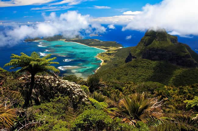
Mount Gower also Big Hill, is the highest mountain on Australia’s subtropical Lord Howe Island in the Tasman Sea. With a height of 875 metres (2,871 ft) above sea level, and a relatively flat 27-hectare (67-acre) summit plateau, it stands at the southern end of Lord Howe, just south of the island’s second highest peak, the 777-metre (2,549 ft) high Mount Lidgbird, from which it is separated by the saddle at the head of Erskine Valley.
Contents
- Map of Mount Gower Lord Howe Island NSW 2898 Australia
- Biking from ned s beach to start of mount gower track on lord howe island
- References
Map of Mount Gower, Lord Howe Island NSW 2898, Australia
Ascending Gower entails a popular, guided, strenuous 8-hour return hike, though no special climbing skills are needed. The mountain is covered with rainforest, including cloud forest at the summit, containing many of the island’s endemic plants.
Biking from ned s beach to start of mount gower track on lord howe island
References
Mount Gower Wikipedia(Text) CC BY-SA