
Mountain type Dolerite | Elevation 316 m | |
 | ||
Similar Grattai Mountain, Mount Ulandra, Mount Tilga, Mount Royal, Grundy Mountain | ||
Glenugie peak
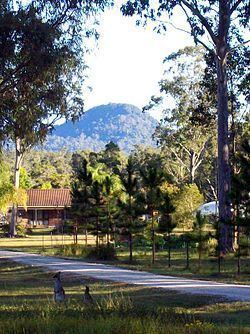
Glenugie Peak, also known as Mount Elaine or as Glen Ugie Peak, a mountain that is part of the ridge surrounding the Clarence Moreton Basin, is situated in the Northern Rivers region of New South Wales, Australia. At an elevation of 316 metres (1,037 ft) above sea level, the mountain is located near the Pacific Highway, south of the town of Grafton and approximately 6 kilometres (3.7 mi) west north-west of the locality of Calamia.
Contents
- Glenugie peak
- Map of Glenugie Peak Glenugie NSW 2460 Australia
- Dancing in search of traction at glenugie peak fire tower trail
- Features and location
- References
Map of Glenugie Peak, Glenugie NSW 2460, Australia
Glenugie Peak is known as Gunayjun to the local Gumbaynggirr people
Dancing in search of traction at glenugie peak fire tower trail
Features and location
It is a dolerite peak from the Cenozoic era extruded from the Grafton Formation. The Grafton Formation is a series of sedimentary rocks, laid down between the late Jurassic and early Cretaceous periods.
Glenugie Peak is noted by Matthew Norman for its dry rainforest in a gully which includes a number of rare species of trees, as well as the Yellow Box, which is more often associated with areas west of the Great Dividing Range. Average annual rainfall is 1,138 millimetres (44.8 in).
Glenugie peak rock was used as ballast for the North Coast railway line and remnants of the tramway used to transport the rock can be seen today.