
Elevation 1,762 m | Prominence 202 m | |
 | ||
Mountain range Brindabella Range, Great Dividing Range Similar Mount Gingera, Mount Franklin, Bimberi Peak, Mount Coree, Mount Tennent | ||
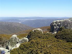
Mount Ginini is a mountain with an elevation of 1,762 metres (5,781 ft) in the Brindabella Ranges that is located on the border between the Australian Capital Territory and New South Wales in Australia. The summit of the mountain is located within the ACT, and is the third highest mountain in the Territory.
Map of Mount Ginini, Cotter River NSW 2611, Australia
The ACT portion of the mountain is located in Bimberi Nature Reserve and Namadgi National Park and the NSW portion in Kosciuszko National Park. It is often climbed by bushwalkers from Corin Dam, as it is a few hours hike. The mountain is close to the Ginini Flats Wetlands Ramsar Site.
The mountain is home to an Airservices Australia installation serving as part of the AERIES network and as a transceiver for communications between ATCs and aircraft. It also hosts a repeater station for the local amateur radio club. The transmitter tower is located at 35°31′46.61″S 148°46′21.06″E.