Harman Patil (Editor)

Mount Gibraltar

Updated on
Edit
Like
Comment
Share on FacebookTweet on TwitterShare on LinkedInShare on Reddit
Elevation
  
863 m

Age of rock
  
150.099534 million years

Mount Gibraltar httpsuploadwikimediaorgwikipediacommonsthu

Location
  
Southern Highlands, New South Wales, Australia

First ascent
  
(by European), John Wilson, 1798

Similar
  
Mount Bindo, Mount Banks, Mount Boyce, Mount Solitary, Mount Trickett

Climbing mount gibraltar


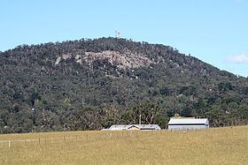
Mount Gibraltar (Aboriginal: Bowrell) is a mountain with an elevation of 863 metres (2,831 ft)   that is located in the Southern Highlands region, between Bowral and Mittagong, in New South Wales, Australia. Further west is Berrima.

Contents

Map of Mount Gibraltar, Bowral NSW 2576, Australia

Wedding in the mount gibraltar gillian ryan


Location and features

The mountain is locally known as 'The Gib', and is in the form of a ridge, rather than an obvious conical peak. The western extremity of the ridge is commonly pointed out as the mountain itself. 'The Gib' is primarily a residential area with a large nature reserve at its peak.

The first European to climb the mountain, in 1798, was explorer John Wilson. He learned from local Aborigines the name 'Bowrell', which meant 'a high place'. Surveyor Sir Thomas Mitchell also climbed Mount Gibraltar.

  • 'The Gib' is thought to have been formed from a collapsed volcanic core, which pushed through the local Hawkesbury Sandstone beds about 150 million years ago.
  • The western slopes were previously the site of a granite quarry which mined the volcanic trachyte; the quarry closed in 1986. The site can be reached by a walking track beginning near Bowral Swimming Pool.
  • The peak is 863 meters above sea-level.
  • The peak area includes the Mount Gibraltar Reserve.
  • The Reserve was acquired by Alderman Joshua Stokes, in 1919. A large stone construction, bearing a memorial plaque to Stokes, is a feature of the Reserve.
  • The Reserve vegetation is a rare remnant of a volcanic soil community. A prominent tree species is Eucalyptus fastigata (Brown Barrel).
  • The Reserve has been the subject of a Landcare Bush Regeneration Program since 1994, with the aim of eliminating introduced species such as Privet, Barberry, Ivy, Honeysuckle, Banana Passionfruit, Inkweed and others.
  • The Landcare group has also compiled a complete Site Species List.
  • 'The Gib' has three lookout points over Bowral and Mittagong.
  • On a clear day 'The Gib' can be seen from Echo Point in Katoomba which is approximately 70–80 km away, although many people confuse it with the nearby, conical Mount Jellore.
  • On a clear day you can make out the Sydney skyline.
  • The exposed, rocky area of the peak is the site of several telecommunications and broadcasting towers, including Telstra microwave transmission links.
  • The residential area of Mount Gibraltar includes some of the most highly priced real estate in the Southern Highlands.
  • Railway

    The Main South Railway skirts Mount Gibraltar at its western foothills, passing through a tunnel under Evans Street, Bowral. The original tunnel was single track, but it was replaced in the 1920s by a double track tunnel.

  • Mount Gibraltar images
  • References

    Mount Gibraltar Wikipedia