
Built 1940 Opened 1940 Architectural style Art Deco | NRHP Reference # 82004243 Area 6,475 m² Added to NRHP 16 July 1982 | |
 | ||
MPS Historic Bridges/Tunnels in Washington State TR Similar Lacey V Murrow Memorial, Homer M Hadley Memorial, Aubrey Davis Park, Schmitz Park Bridge, North Queen Anne Driv | ||
link elevated 3 mount baker tunnel station
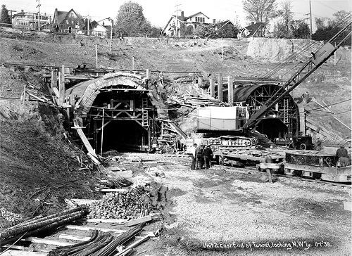
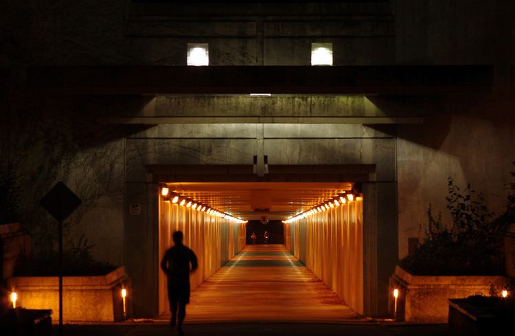
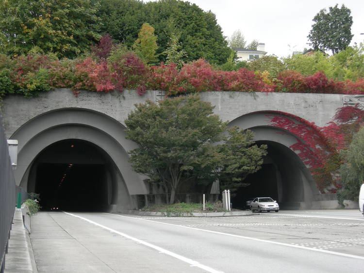
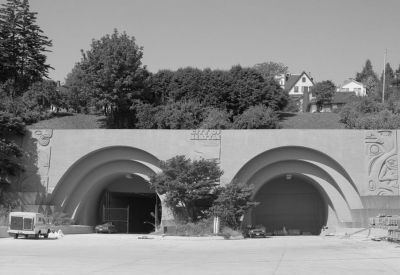
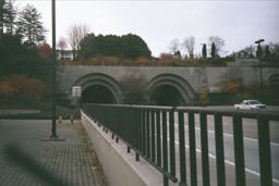
The Mount Baker Tunnel or Mount Baker Ridge Tunnel carries Interstate 90 under the Mount Baker neighborhood of Seattle, Washington. It is actually a group of three tunnels that carry eight lanes of freeway traffic, plus a separate path for bicycles and pedestrians. The two originals are twin tunnel bores completed in 1940 and rehabilitated in 1993. The newest tunnel was built north of the original tunnels and opened in June 1989. The tunnel has a double-decked roadway with the bicycle/pedestrian path above the traffic lanes.
Contents
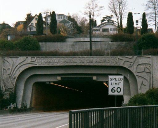
The entire tunnel is listed on the National Register of Historic Places (NRHP), ID #82004243. The east portals of the tunnel, with murals designed by artist James FitzGerald, along with the Lacey V. Murrow Bridge, are an official City of Seattle landmark.
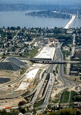
The official length is 1,440 feet (440 m), though the perceived length while driving is closer to a 1 kilometre (3,300 ft) because of a cut-and-cover "lid" between the western portal and the beginning of the actual tunnel under the Mount Baker ridge. The eastern end of the tunnel links to the I-90 floating bridge on Lake Washington.
At 63 feet (19 m) in diameter, it is the world's largest diameter soft earth tunnel, having been bored through clay.
Original
When completed in 1940, the twin tunnels connected the I-90 floating bridge on Lake Washington and Rainier Avenue South in Seattle. The bridge and tunnels were part of US Highway 10, which used surface streets between the tunnels and downtown Seattle. US 10 was a four-lane, undivided highway. Each tunnel held two traffic lanes. The north tunnel normally carried two westbound lanes. The south tunnel normally carried two eastbound lanes. In the 1960s, a lane-use signal system was added to improve peak commute traffic. During peak commute times, the signals were used to make the center two lanes reversible. In the mornings, three lanes flowed west and one lane flowed east. In the evenings, three lanes flowed east and one lane flowed west. During morning and evening commutes, one tunnel carried two lanes of traffic in the same direction while the other tunnel carried opposing traffic separated by only dashed yellow lines.
The highway would later become part of Interstate 90, be expanded, and upgraded to a controlled-access freeway. The freeway expansion and upgrade was completed in 1993.
Current
Upon completion of the I-90 expansion, the freeway capacity increased to three general-purpose lanes in each direction and two reversible HOV lanes. Eastbound traffic uses the original tunnels. Westbound traffic uses the upper deck of the northern new tunnel. A two-lane reversible roadway uses the lower deck. The reversible roadway serves as express lanes for transit buses and carpools (2+ people) during peak commute periods. The express lanes flow westbound on weekday mornings and eastbound on weekday afternoons and evenings. On weekends, the express lanes are open; traffic direction is variable depending on anticipated traffic volumes. When the express lanes are open to eastbound traffic, single-occupant vehicles headed to Mercer Island are allowed to use the lanes.
Future use
The Washington State Department of Transportation is renovating I-90 between Interstate 5 and the East Channel Bridge to add one HOV lane in each direction. WSDOT is also modifying the Bellevue Way exit and entrance ramps. On Mercer Island, WSDOT and Sound Transit are building direct access ramps to allow buses and HOVs to exit and enter I-90 from the future HOV lanes. When the HOV lanes and direct access ramps are complete, the express lanes will be dedicated to Eastside Link light rail use.
Sound Transit will soon begin to build light rail rapid transit in the current I-90 Express Lanes for the East Link light rail line connecting Seattle with the Bellevue and Redmond suburbs. Voters in urban and suburban King, Pierce, and Snohomish counties rejected the measure on November 6, 2007, as part of an $18 billion "Roads and Transit" construction package, but approved the plan a year later as part of a transit-only initiative.