
River mouth Meurthe215 m (705 ft) Length 75 km | Basin size 582 km (225 sq mi) Basin area 582 km² | |
 | ||
Main source Saint-Léonard550 m (1,800 ft) Discharge Average rate:6.72 m/s (237 cu ft/s) | ||
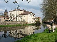
The Mortagne (French: la Mortagne) is a 74.6-kilometre (46.4 mi) long river in the Vosges and Meurthe-et-Moselle départements, northeastern France. Its source is at Saint-Léonard, 5 km (3.1 mi) west of the village, in the Vosges Mountains. It flows generally northwest. It is a left tributary of the Meurthe into which it flows at Mont-sur-Meurthe, 5 km (3.1 mi) southwest of Lunéville.
Contents
Map of La Mortagne, France
Communes along its courseEdit
This list is ordered from source to mouth:
References
Mortagne (river) Wikipedia(Text) CC BY-SA