OS grid reference TG008438 Area 8.68 km² | Civil parish Morston Sovereign state United Kingdom Local time Sunday 6:26 AM Post town Holt | |
 | ||
Weather 11°C, Wind SW at 40 km/h, 87% Humidity | ||
Morston is a village and civil parish in the English county of Norfolk. It covers an area of 8.68 km2 (3.35 sq mi) and had a population of 86 in 42 households at the 2001 census. The population remained less than 100 at the 2011 Census and was included in the civil parish of Blakeney. For the purposes of local government, it falls within the district of North Norfolk.
Map of Morston, UK
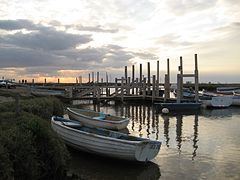
Like its neighbour Blakeney, Morston, used to be a major port 400 years ago, but is now only used by a small number of fishing boats, leisure craft and the regular seal watching trips which leave for Blakeney Point.
Morston Hall restaurant is located in the parish.
References
Morston Wikipedia(Text) CC BY-SA
