
Country United States County Conway Time zone Central (CST) (UTC-6) Local time Saturday 11:45 PM Population 6,799 (2013) | Elevation 384 ft (117 m) Area code(s) 501 Zip code 72110 | |
 | ||
Weather 12°C, Wind SW at 0 km/h, 78% Humidity | ||
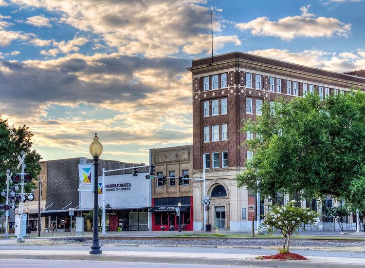
Morrilton is a city in Conway County, Arkansas, United States, less than 50 miles (80 km) northwest of Little Rock. The city is the county seat of Conway County. The population was 6,767 at the 2010 census.
Contents
- Map of Morrilton AR 72110 USA
- History
- Geography
- Demographics
- Public and private schools
- Colleges and universities
- Notable people
- Climate
- References
Map of Morrilton, AR 72110, USA
History
Morrilton was incorporated on November 24, 1879, and is named after landowners E.J. and George H. Morrill. Most of the downtown area is built on the farm adjacent to the Morrills formerly owned by James M. Moose.
The city was home to Harding College, now Harding University of Searcy, Arkansas, for about a decade in the 1920s and 1930s. The original campus of Harding University is now the Southern Christian Home, a church-supported residential child care facility.
Geography
Morrilton is located in southern Conway County at 35°9′23″N 92°44′31″W (35.156373, -92.741944). It is bordered on the south by the Arkansas River.
Interstate 40 passes through the northern side of the city, leading southeast 48 miles (77 km) to Little Rock and west 107 miles (172 km) to Fort Smith. U.S. Route 64 (East and West Broadway Street) is the main road through the city center, leading east 6 miles (10 km) to Plumerville and northwest 13 miles (21 km) to Atkins. Arkansas Highway 9 forms an eastern bypass of Morrilton and leads north 40 miles (64 km) to Clinton and south across the Arkansas River 13 miles (21 km) to Perryville.
According to the United States Census Bureau, Morrilton has a total area of 9.2 square miles (23.7 km2), of which 8.7 square miles (22.6 km2) is land and 0.39 square miles (1.0 km2), or 4.29%, is water.
Demographics
As of the 2010 Census, 6,767 people and 2,759 households resided within the city.
2000 Census results showed 1,724 families residing in the city. The population density was 796.7 people per square mile (307.7/km²). There were 2,947 housing units at an average density of 358.4 per square mile (138.4/km²). The racial makeup of the city was 78.38% White, 17.47% Black or African American, 0.79% Native American, 0.34% Asian, 0.02% Pacific Islander, 1.37% from other races, and 1.63% from two or more races. 3.37% of the population were Hispanic or Latino of any race.
There were 2,645 households out of which 30.1% had children under the age of 18 living with them, 46.2% were married couples living together, 15.8% had a female householder with no husband present, and 34.8% were non-families. 32.2% of all households were made up of individuals and 16.3% had someone living alone who was 65 years of age or older. The average household size was 2.35 and the average family size was 2.94.
In the city, the population was spread out with 25.4% under the age of 18, 8.7% from 18 to 24, 26.0% from 25 to 44, 20.2% from 45 to 64, and 19.7% who were 65 years of age or older. The median age was 38 years. For every 100 females there were 84.1 males. For every 100 females age 18 and over, there were 79.5 males.
The median income for a household in the city was $28,007, and the median income for a family was $36,432. Males had a median income of $30,123 versus $19,213 for females. The per capita income for the city was $16,957. About 13.4% of families and 17.1% of the population were below the poverty line, including 21.6% of those under age 18 and 12.8% of those age 65 or over.
Public and private schools
The community is served by two secondary schools. Morrilton High School and the South Conway County School District serve Morrilton as its public school system, where Sacred Heart Catholic School is private.
Colleges and universities
Morrilton is home to the University of Arkansas Community College at Morrilton.
Notable people
Climate
The climate in this area is characterized by hot, humid summers and generally mild to cool winters. According to the Köppen Climate Classification system, Morrilton has a humid subtropical climate, abbreviated "Cfa" on climate maps.