
Postcode(s) 4614 Parish Cooyar | Elevation 407 m (1,335 ft) County Cavendish Postal code 4614 | |
 | ||
Weather 22°C, Wind SW at 16 km/h, 31% Humidity | ||
Yarraman is a town in Queensland, Australia. The town is located 181 kilometres (112 mi) northwest of the state capital, Brisbane on the junction of the New England and D'Aguilar highways.
Contents
Map of Yarraman QLD 4614, Australia
History
The creek at Yarraman was used in the 1870s as a place for local graziers and stockmen to meet and trade cattle. The township was established in the late 1870s. Yarraman means "horse" in the Port Jackson Pidgin English spread by Aboriginal stockmen in eastern Australia. It is thought to be derived from the word "yira" or "yera" which means large teeth, possibly from one of the Sydney languages.
A school was opened in 1901.
As there were many large hoop pine forests in the area, a timber mill was established in 1910.
The town was connected to Brisbane and Ipswich by railway in 1913. The railway line was closed in 1988.
Census data
Based on data gathered through the census, Yarraman's population has grown as shown below.
Today
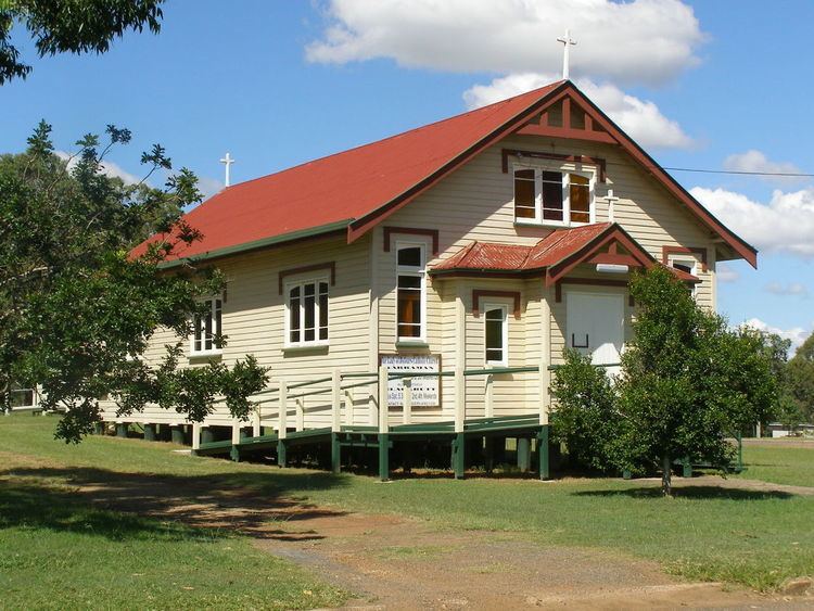
Yarraman is set in a fertile valley and produces timber, grain and beef and dairy goods, which it exports to larger cities. It has a community radio station Wild Horse FM 99.7. It is served by three churches: St Philip's Anglican Church, Our Lady of Dolours Catholic Church, and Calvary Lutheran church.
Yarraman is surrounded by the various components of the fragmentary Bunya Mountains and Yarraman Important Bird Area which contains the largest remaining population of the vulnerable black-breasted button-quail.
Amenities
The Yarraman Library and Post Office are located on the corner of Toomey and Douglas Streets.
The Yarraman Memorial Pool is located in Margaret Street, on the New England Highway.
Military History
During World War 2, Yarraman was the location of RAAF No.21 Inland Aircraft Fuel Depot (IAFD), completed in 1942 and closed on 29 August 1944. Usually consisting of 4 tanks, 31 fuel depots were built across Australia for the storage and supply of aircraft fuel for the RAAF and the US Army Air Forces at a total cost of £900,000 ($1,800,000).