
- elevation 489 m (1,604 ft) - elevation 356 m (1,168 ft) | - location La Ronge Length 100 km Country Canada | |
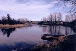 | ||
The Montreal River is a river in Census Division No. 18, Saskatchewan, Canada. It flows 100 kilometres (62 mi) from Montreal Lake to Lac la Ronge, and is part of the Churchill River and Hudson Bay drainage basins.
Contents
Map of Montreal River, Saskatchewan, Canada
Course
The river begins at Montreal Lake 5 kilometres (3.1 mi) north of the community of Molanosa and 4 kilometres (2.5 mi) west of Saskatchewan Highway 969. It heads north and passees under at Saskatchewan Highway 2 at the site of the Montreal River Provincial Recreation Site. The river continues north, passes under Saskatchewan Highway 165, heads east through Partridge Crop Lake and Sikachu Lake and enters Egg Lake (Saskatchewan) at Wawe Bay. It continues east through Bigstone Lake, passes again under Saskatchewan Highway 2, and reaches its mouth at Lac la Ronge between the communities of La Ronge and Air Ronge.
Fish species
The fish species include walleye, sauger, yellow perch, northern pike, lake trout, lake whitefish, cisco, burbot, white sucker and longnose sucker.