
Named for James Robertson Congressional district 6th Area 1,233 km² Population 67,383 (2013) | Largest city Springfield Time zone Central: UTC-6/-5 Founded 9 April 1796 County seat Springfield | |
 | ||
Website www.robertsoncountytn.org Cities Springfield, Greenbrier, Cross Plains, Cedar Hill, Orlinda, Coopertown, Adams Rivers Sulphur Fork Creek, Syca Creek, Red River Points of interest Sumner Crest Winery, Bell Witch Cave, J Travis Price Park, Robertson County History, Welcome Center Tennessee | ||
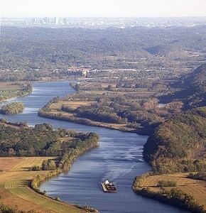
South logan county kentucky and north robertson county tennessee
Robertson County is a county located in the U.S. state of Tennessee. As of the 2010 census, the population was 66,283. Its county seat is Springfield. The county was named for James Robertson, founder of Nashville and a state senator.
Contents
- South logan county kentucky and north robertson county tennessee
- Map of Robertson County TN USA
- Geography
- Adjacent counties
- State protected areas
- Demographics
- Cities
- Towns
- References
Map of Robertson County, TN, USA
Robertson County is a component of the Nashville-Davidson–Murfreesboro–Franklin, TN Metropolitan Statistical Area.
Geography
According to the U.S. Census Bureau, the county has a total area of 476 square miles (1,230 km2), of which 476 square miles (1,230 km2) is land and 0.2 square miles (0.52 km2) (0.04%) is water.
Adjacent counties
State protected areas
Demographics
As of the census of 2000, there were 54,433 people, 19,906 households, and 15,447 families residing in the county. The population density was 114 people per square mile (44/km²). There were 20,995 housing units at an average density of 44 per square mile (17/km²). The racial makeup of the county was 89.13% White, 8.62% Black or African American, 0.28% Native American, 0.31% Asian, 0.02% Pacific Islander, 0.83% from other races, and 0.80% from two or more races. 2.66% of the population were Hispanic or Latino of any race.
In 2005 the racial makeup of the county was 85.4% non-Hispanic whites, 8.3% African-Americans and 5.3% Latinos.
There were 19,906 households out of which 37.40% had children under the age of 18 living with them, 61.90% were married couples living together, 11.20% had a female householder with no husband present, and 22.40% were non-families. 18.60% of all households were made up of individuals and 7.50% had someone living alone who was 65 years of age or older. The average household size was 2.71 and the average family size was 3.06.
In the county, the population was spread out with 26.80% under the age of 18, 8.50% from 18 to 24, 31.40% from 25 to 44, 22.50% from 45 to 64, and 10.80% who were 65 years of age or older. The median age was 35 years. For every 100 females there were 98.80 males. For every 100 females age 18 and over, there were 95.70 males.
The median income for a household in the county was $43,174, and the median income for a family was $49,412. Males had a median income of $34,895 versus $24,086 for females. The per capita income for the county was $19,054. About 6.40% of families and 9.00% of the population were below the poverty line, including 10.90% of those under age 18 and 13.10% of those age 65 or over.