Peak La Pita | Elevation 1,000 m (3,300 ft) Area 2,677 km² | |
 | ||
Similar Sierra Nevada de Santa Ma, Serranía del Baudó, Serranía de la Macarena, Serranía del Darién, Paramillo Massif | ||
Petrona marti nez un nin o llora en los montes de mari a amplificado bol var colombia
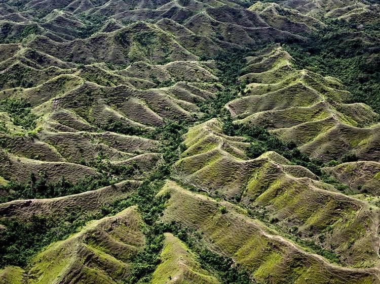
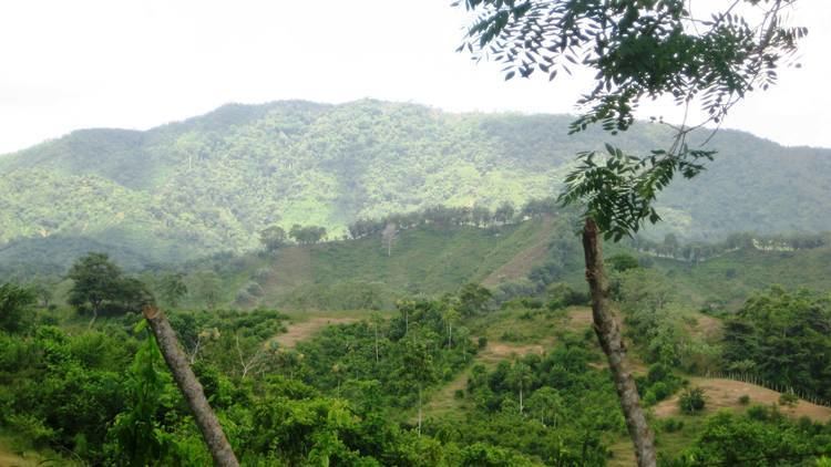
The Montes de María is an isolated group of small mountains near the northern coast of Colombia in the Caribbean Region. The Montes de María (also known as Serranía de San Jacinto) are the last part of the Serranía de San Jerónimo which extends from the West Andes. A part of the mountains are protected as the SFF Los Colorados.
Contents
- Petrona marti nez un nin o llora en los montes de mari a amplificado bol var colombia
- Petrona mart nez un ni o que llora en los montes de mar a
- References
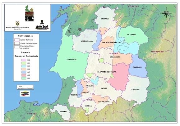
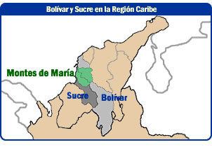
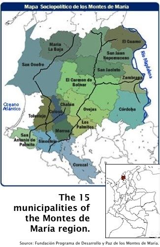
Montes de María is a zone located in the center of the Colombian Departments of Bolívar and Sucre. The following towns are part of the Montes de María: El Carmen de Bolívar, María La Baja, San Juan Nepomuceno, San Jacinto, Córdoba, Zambrano and El Guamo in Bolivar; Ovejas, Chalán, Colosó, Morroa, Toluviejo, Los Palmitos, San Onofre and San Antonio de Palmitos in Sucre.
It has a total area of 6,317 km2 (2,439 sq mi), of which 3,798 km2 (1,466 sq mi) are in Bolívar and 2,519 km2 (973 sq mi) in Sucre. This area has a population of about 330,889.
Montes de María comprises three zones: The first zone is relatively flat with no mountains: the area located between the Troncal de Occidente and the Magdalena River is dedicated to cattle-raising and forestry, while the area located between the Transversal del Caribe and the Canal del Dique is mainly agricultural. A second, mountainous, zone, located between the Transversal del Caribe and Troncal de Occidente also has agriculture as the main activity. The third zone, in the west, corresponds to the town of San Onofre.
Petrona mart nez un ni o que llora en los montes de mar a