
Canton Fayence Time zone CET (UTC+1) Local time Friday 11:40 PM | Department Var Population (2006) 4,843 Area 33.54 km² | |
 | ||
Weather 10°C, Wind NW at 18 km/h, 61% Humidity | ||
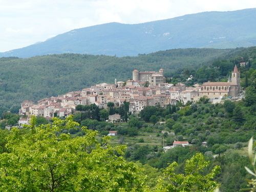
Montauroux is a commune in the Var department in the Provence-Alpes-Côte d'Azur region in southeastern France.
Contents
Map of 83440 Montauroux, France
Its neighbor town is the picturesque Callian which can be seen across a small valley.
Geography
Montauroux is situated in the east of the Var and at the border of the Alpes-Maritimes. Montauroux rises in tiers of altitudes from 150 m to 400 m. The village has a southern exposure, facing the Esterel massif and the St Cassien Lake. Montauroux is located midway between the sea which is 30 km (19 mi) away and the first ski resort which is 40 km (25 mi), away. Montauroux benefits from an exceptional amount of sunny days and is visited by tourists in the summer months, many hotels are often fully booked for the summer by mid-April or earlier.
It is also part of the Pays de Fayence, a communauté de communes.