
Topo map NTS 031H/07 Elevation 411 m | Province Québec | |
 | ||
Similar Mont Rougemont, Mont Shefford, Mont Saint‑Bruno, Mont Mégantic, Mont Saint‑Hilaire | ||
Parapente mont yamaska
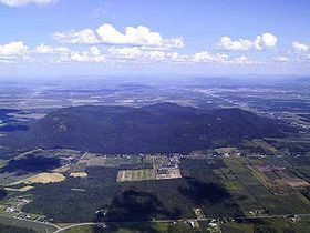
Mont Yamaska is part of the Monteregian Hills in southern Quebec. Its summit stands 411 m (1,348 ft) above sea level. This mountain is largely covered with deciduous forest dominated by sugar maple. Some apple orchards are raised on lower slopes.
Contents
- Parapente mont yamaska
- Map of Mont Yamaska Saint Paul dAbbotsford QC Canada
- Busy sunday at mont yamaska
- GeologyEdit
- References
Map of Mont Yamaska, Saint-Paul-d'Abbotsford, QC, Canada
Busy sunday at mont yamaska
GeologyEdit
Mont Yamaska is composed of igneous rock and hornfels. The igneous rock is mostly mafic with much gabbro, essexite, and a titanium-rich pyroxenite. Mont Yamaska might be the deep extension of a vastly eroded ancient volcanic complex, which was probably active about 125 million years ago. The mountain was created when the North American Plate moved westward over the New England hotspot, along with the other mountains of the Monteregian Hills that form part of the Great Meteor hotspot track.
References
Mont Yamaska Wikipedia(Text) CC BY-SA