
Prominence 1,850 m (6,070 ft) Last eruption Unknown First ascent 1975 Listing Ultra-prominent peak | Elevation 1,850 m | |
 | ||
Similar Pic du Mascarin, Mawson Peak, Monte Emilius, Mount Terror, Peter I Island | ||
Mont Ross is a stratovolcano, the highest mountain in the Kerguelen Islands at 1,850 metres (6,070 ft). It is located in the Gallieni Massif, at the end of the Gallieni Peninsula, east of Baie Larose on the main island of Grande Terre. The volcano is composed primarily of trachybasalt and was active during the late Pleistocene.
Contents
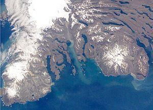
Map of Mont Ross, French Southern and Antarctic Lands
History
Mont Ross was named after explorer Sir James Clark Ross. The first human being to set foot on its summit was French military engineer Henri Journoud, using a helicopter, in the early 1960s. The mountain was, however, first climbed in 1975 by Jean Afanassieff and Patrick Cordier, the last French mountain to be climbed.
References
Mont Ross Wikipedia(Text) CC BY-SA