
Prominence 730 m | Elevation 1,567 m | |
 | ||
Similar Mont Lozère, Pic Saint‑Loup, Mont Ventoux, Pic de Finiels, Canigou | ||
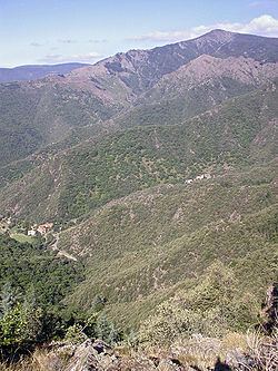
Mont Aigoual (Occitan: Mont Augal, elevation 1567m / 5141 ft) is the highest point of the Gard département, France. It is part of the Massif Central, and it is located within the Cévennes National Park. Its southern slopes are the source of the river Hérault flowing into the Mediterranean.
Contents
- Map of Mont Aigoual 30570 Valleraugue France
- GeographyEdit
- Tour de FranceEdit
- The Rider by Tim KrabbEdit
- References
Map of Mont Aigoual, 30570 Valleraugue, France
When the sky is clear, it is possible to see the Mediterranean Sea, the Pyrenees, and also the Alps and Mont Blanc in particular. The summit is accessible by car from a variety of converging surfaced approaches.
GeographyEdit
This granite and schist outcrop is a major water catchment area in the Massif Central, being located where clouds from the cold Atlantic converge with warm Mediterranean air currents. The heavy rainfall has given the mountain its name: originally "Aiqualis" ('the watery one'). In an average year rainfall can measure up to 2250 mm (over 7 ft), making it the wettest place in France. Mont Aigoual forms part of the watershed between the Mediterranean and Atlantic.
The meteorological observatory, built in 1887 by the French Rivers Authority and Forestry Commission under the direction of Georges Fabre, is currently occupied by the French meteorological service (Météo France). It is the last remaining weather station in France which is still inhabited by meteorologists. An exhibition on weather forecasting is open to visitors in the summer months.
Severe weather conditions are sometimes recorded:
Mont Aigoual features a cool-summer variant of an oceanic climate (Cfc), bordering to a subpolar (Dfc) (highland) climate.
Tour de FranceEdit
The col de Mont Aigoual (1507 metres) has been used once by the Tour de France. In 1987 Silvano Montini (Italy) was first over the summit.
The Rider by Tim KrabbéEdit
The Tour of Mont Aigoual is the semi-fictional cycle race in the book The Rider by Tim Krabbé.
The race is recreated on the Rapha and on the inrng weblogs