
Population 1,008 (2011) Post town LEEDS | OS grid reference SE505295 Sovereign state United Kingdom Local time Thursday 10:24 AM District Selby District | |
 | ||
Weather 11°C, Wind SW at 19 km/h, 81% Humidity | ||
Monk fryston oops near miss rear end
Monk Fryston is a small village and civil parish in the Selby district of North Yorkshire, England.
Contents
Map of Monk Fryston, Leeds, UK
The Dictionary of British Place Names notes Monk Fryston as "Fristun" (c.1030) and "Munechesfryston" (1166). The name derives from the Old English for "farmstead of the frisians", with prefix 'Monk' relating to it being an 11th-century possession of Selby Abbey. According to a personal FreeUK web page, the name of the village originates from Monk's Free Stone as all of the stone used to build Selby Abbey was obtained from a quarry in the centre of the village across the road from the old school building. The quarry was filled in for a housing development located next to the new school building, built on the old school field in 1998-99. The old school building has since been converted to housing.
The village is very closely linked to Hillam, although both villages maintain separate parish councils.
According to the 2011 UK census the population of Monk Fryston parish was 1008 and the number of households was 406.
Monk Fryston is situated just over 6 miles (10 km) west of the town of Selby. It lies 2 miles (3 km) east of the A1(M) motorway junction 42, (A1 road), and 5 miles (8 km) north of the M62 motorway, junction 33, at Ferrybridge. The A63 road, Leeds to Selby, runs through the village.
Primary education needs are served by Monk Fryston Church of England Primary school.
The Parish Church is St Wilfrid's Monk Fryston (Church of England).
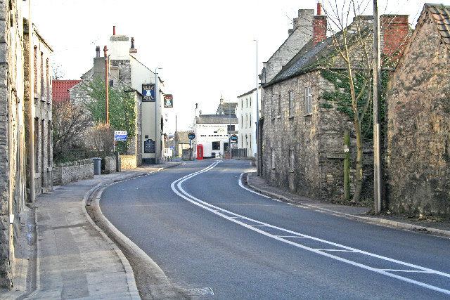
The village has one public house, The Crown Inn, which dates back to the 1600s, and a hotel, the Monk Fryston Hall Hotel which dates back to the 12th century.
The National Heritage List for England, compiled by English Heritage, holds 15 listed buildings for Monk Fryston. The list includes the Grade l St Wilfrid's Church, the Grade ll* Monk Fryston Hall and two Grade ll milestones.
The York and North Midland Railway passes to the west of Monk Fryston. An old station platform still exists next to the railway just down from the South Milford sidings. The spot is popular with train enthusiasts.
Governance
Monk Fryston is part of the Monk Fryston and South Milford electoral ward. This ward had a total population taken at the 2011 Census of 4,096.