
Gaelic name Monadh Craoibhe OS grid reference NO122220 Area rank 209 (Freshwater: 7) Area 46 ha | Meaning of name Moorland of the Tree Highest elevation 5 m Council area Perth and Kinross | |
 | ||
Similar | ||
Moncreiffe Island, also known as Friarton Island divides the River Tay into two channels as it flows through Perth in Scotland. It is crossed by the railway line to Dundee.
Contents
Map of Moncreiffe Island, Perth, UK
History
Moncreiffe House was built in 1679, by the architect Sir William Bruce. It incorporated an older tower house and burned down in November 1957, claiming the life of Sir David Moncreiffe of that Ilk, 10th Baronet, the twenty-third Laird of Clan Moncreiffe. This tragedy led to the chiefship of the great Scottish herald and historian Sir Iain Moncreiffe of that Ilk, 11th Baronet.
Land use
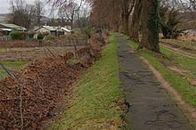
The King James VI Golf Course is situated on and covers much of the island with the remaining land used for allotments.
Wildlife
There are Wild Onions (Ramsons), Common Bluebells, Sweet Cicely, Broom and Dog Violets.