
Time zone CET (UTC+1) Local time Thursday 5:49 AM | Canton Vitry-en-Artois Area 9.26 km² Population 521 (1999) | |
 | ||
Weather 4°C, Wind S at 3 km/h, 98% Humidity | ||
Monchy-le-Preux is a commune in the Pas-de-Calais department in the Hauts-de-France region of France.
Contents
Map of Monchy-le-Preux, France
Geography
Monchy-le-Preux is situated 6 miles (10 km) southeast of Arras, at the junction of the D33 and the D339 roads. Junction 15 of the A1 autoroute is just a mile away.
History
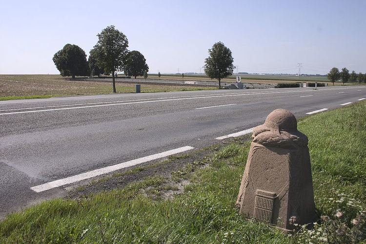
Monchy was an important strategic position near to Arras during the 1914-18 war and bloody fighting ensued around the village. During the Battle of Arras it was from here that the Germans bombarded Arras and destroyed the belltower. Just outside Monchy, on the D939, a carved Vauthier Stone marks the boundary of the advancing German army during the First World War.
Places of interest
References
Monchy-le-Preux Wikipedia(Text) CC BY-SA