
Population 27 (2011 census) Gazetted 14 October 2010 | ||
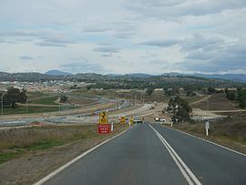 | ||
Location 10 km (6 mi) W of Canberra City | ||
The District of Molonglo Valley is one of the nineteen districts of the Australian Capital Territory used in land administration, and the only district that was not created in 1966. The district is subdivided into divisions (suburbs), sections and blocks and is the newest district of Canberra, the capital city of Australia. The district is planned to consist of thirteen suburbs, planned to contain 33,000 dwellings, with an expected population of between 50,000 and 73,000. To be developed in three stages over more than ten years, the district will contain a principal town centre and a secondary group centre, with residential suburbs located to the south and north of the Molonglo River; located to the west of Lake Burley Griffin.
Contents
- Map of Molonglo Valley ACT 2611 Australia
- Establishment and governance
- Political representation
- Location and urban structure
- List of suburbs
- References
Map of Molonglo Valley ACT 2611, Australia
The name molonglo is derived from an Aboriginal expression meaning "the sound of thunder".
At the 2011 census, the population of the district was 27.
Establishment and governance
The traditional custodians of the district are the indigenous people of the Ngunnawal tribe.
Following the transfer of land from the Government of New South Wales to the Commonwealth Government in 1911, the eighteen original districts were established in 1966 by the Commonwealth via the gazettal of the Districts Ordinance 1966 No. 5 (Cth) which, after the enactment of the Australian Capital Territory (Self-Government) Act 1988 (Cth), became the Districts Act 1966 No. 5 (ACT). This Act was subsequently repealed by the ACT Government and the eighteen original districts were administered subject to the Districts Act 2002 (ACT).
The land was used for pine forests prior to the devastation caused by the 2003 Canberra bushfires; leaving the land empty and ready for potential development. To accommodate future expected population growth and housing demand, The Canberra Spatial Plan, already in development at that time and formally released during 2004, proposed increased urban density along established (road) transport corridors. Further land releases were proposed, including continuing development in the district of Gungahlin by maintaining Burley Griffin's 1967 "Y-Plan"; and the development of new releases in the Molonglo Valley, previously set aside as green corridors.
The district was formally gazetted on 14 October 2010.
Political representation
For the purposes of Australian federal elections for the House of Representatives, the District of Molonglo Valley is contained within the Division of Canberra.
For the purposes of Australian Capital Territory elections for the ACT Legislative Assembly, the District of Molonglo Valley is within the Murrumbidgee electorate.
Location and urban structure
The Molonglo Valley district is located to the north of the district of Weston Creek and to the south of the district of Belconnen. It is within relatively close proximity of the city; approximately 10 kilometres (6.2 mi) west of the Canberra central business district. By releasing land closer to the city, it is expected to reduce urban sprawl in Canberra. However, the close proximity to the city will mean that the land will be in high demand and is therefore likely to be quite expensive..
The first two suburbs currently under construction in Molonglo Valley are Wright and Coombs; they are named for poet, environmentalist and Aboriginal land rights advocate Judith Wright and prominent public servant and economist H. C. "Nugget" Coombs, the first Reserve Bank Governor. The next suburb planned will be named Denman Prospect, named after Lord and Lady Denman, followed by Molonglo, a local Aboriginal word for thunder. Sulman, is named for architect and town planner Sir John Sulman, whose work can be seen in Civic.
Coombs will be located on the southern bank of the Molonglo River and north-east of John Gorton Drive (the Molonglo Valley North-South Arterial road). Wright lies further west, north of Duffy, and south-west of John Gorton Drive. Land for these suburbs was released in late May 2010.
It is also expected that the development of the Molonglo Valley district will act as a link between the town centres of Weston Creek to the south and Belconnen to the north..