
Elevation −1 m (−3 ft) Postcode 2957–2977 Local time Wednesday 10:49 PM Area code 0184 | Established 1 January 2013 Time zone CET (UTC+1) Area 126.4 km² | |
 | ||
Website www.gemeentemolenwaard.nl Weather 6°C, Wind SE at 2 km/h, 86% Humidity | ||
Molenwaard is a municipality in the western Netherlands, in the southeastern part of the province of South Holland, and the northwestern part of the region of Alblasserwaard. It has been the result of a merger of the municipalities of Graafstroom, Liesveld, and Nieuw-Lekkerland on 1 January 2013. Molenwaard has about 29,000 inhabitants and an area of about 126 km2 (49 sq mi). Biggest places are Bleskensgraaf, Groot-Ammers, and Nieuw-Lekkerland.
Contents
Map of Molenwaard, Netherlands
The municipality of Molenwaard lies about 1.5 m below sea level. It is bordered by the Lek river in the north and the Noord river in the west (just a small part). On its area flows the Graafstroom or Alblas river.
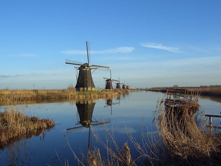
Molenwaard can be characterized as a landscape of polders existing of vast pastures traversed by ditches and canals, like the Groote- of Achterwaterschap, and the Ammersche Boezem. In the outermost northwest one can find the famous windmills of Kinderdijk.
From a churchly point of view the municipality belongs to the Bible Belt, with as outcome the dominating of the Christian parties in politics.
Localities
Molenwaard consists of the following settlements:
Dutch Topographic map of the municipality of Molenwaard, June 2015
Politics
The municipal council of Molenwaard consists of 21 seats, which are divided as follows: