
Primary inflows Surface area 29.4 km (11.4 sq mi) Area 29.4 km² Mean depth 18 m | Average depth 18.3 m (60 ft) Surface elevation 692 m Province British Columbia | |
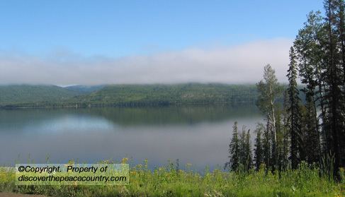 | ||
Moberly Lake along British Columbia Highway 29 in northern British Columbia, Canada, is named for Henry John Moberly, a fur trader that lived on the lake. It is served by the Chetwynd Royal Canadian Mounted Police (RCMP) detachment.
Contents
Map of Moberly Lake, British Columbia, Canada
The Moberly Lake has always been a revered site for the Danezaa people. They called it 'the Lake you can depend on,' an allusion to the bounty of the lake, where they could always find food.
Legends
Other Danezaa regarded the lake as a place of mystique. For them, it was 'the Lake with a hole through it' or 'the lake with no bottom'. According to their lore, the lake was the dwelling place of an ancient creature that came to the surface after long intervals below the water.
References
Moberly Lake (British Columbia) Wikipedia(Text) CC BY-SA