
Country United States County Macon FIPS code 29-40682 Elevation 285 m Population 1,357 (2013) Area code 660 | Time zone Central (CST) (UTC-6) GNIS feature ID 0739998 Zip code 63549 Local time Friday 2:19 AM | |
 | ||
Weather -2°C, Wind N at 21 km/h, 61% Humidity Area 4.144 km² (4.118 km² Land / 3 ha Water) | ||
How to say or pronounce usa cities la plata missouri
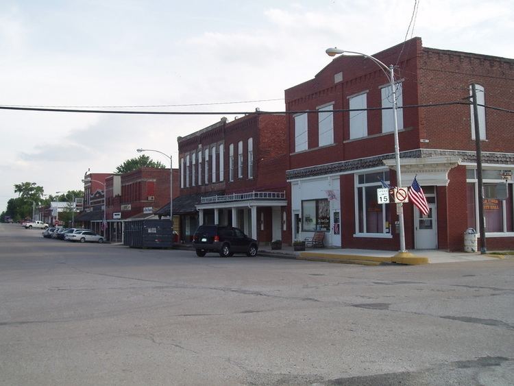
La Plata is a city in Macon County, Missouri, United States. The population was 1,366 at the 2010 census.
Contents
- How to say or pronounce usa cities la plata missouri
- Map of La Plata MO 63549 USA
- History
- Geography
- 2010 census
- 2000 census
- Education
- Transportation
- Notable people
- References
Map of La Plata, MO 63549, USA
History
The beginnings of La Plata can be traced back to March 17, 1827 when Drury Davis established a trading post near the town's current location. The ensuing few years saw Davis joined by family and friends to create a small village that included a blacksmith shop, an inn, and stagecoach station.
La Plata was platted in 1855. It was named after the city of La Plata, in Argentina. The name is of Spanish origin meaning "Silver". Two men, Louis Gex and Thomas Saunders, were the primary force behind the town's platting, and drew straws to choose the community's name. Saunders wanted to name the town Charlottesville to honor a favorite sister, while Gex pushed for the name La Plata. Gex won out and the town is believed to have been first incorporated on September 29, 1856. Another of the early settlers who helped in creating the town was Dr. W. W. Moore, who erected La Plata's first hotel. The North Missouri (later known as the Wabash Railroad) came to town in 1867, and the Santa Fe Railroad twenty years later, passing through La Plata on its route from Chicago to Kansas City. The combination of the two railroads made La Plata an ideal shipping point for timber, livestock, grains, and other goods for northern Macon county and southern portions of neighboring Adair county as well. As part of this growth, the town was incorporated as a fourth-class city on April 4, 1881 with Jacob Gilstrap serving as first mayor. La Plata's first major industry, a creamery, was established in 1883. The facility had the capacity to produce up to 1.25 tons of butter per day. However, fire destroyed the creamery and it was never rebuilt. Other light agriculture-related industry has existed in the town over the years, including a large chicken hatchery and turkey hatchery. Two major oil pipelines pass through La Plata as well, the Prairie Pipeline being the first in 1912. A "tank farm" of large storage tanks was located for many years on the city's northern edge. The Wabash railroad no longer exists, but the Amtrak station is still running on the Santa Fe rail system, and the town is served by the Southwest Chief. A small but active business community still exists in the town.
The first school, named Long Branch for a nearby creek, was established in 1868. It was soon replaced, in 1872, by a five-room brick schoolhouse. Today children of La Plata and the surround rural area educated by the La Plata R-2 school district.
The Lester and Norma Dent House, John T. and Mary M. Doneghy House, Gilbreath-McLorn House, and La Plata Square Historic District are listed on the National Register of Historic Places.
Geography
La Plata is located at 40°1′26″N 92°29′32″W (40.024013, -92.492279). According to the United States Census Bureau, the city has a total area of 1.60 square miles (4.14 km2), of which, 1.59 square miles (4.12 km2) is land and 0.01 square miles (0.03 km2) is water.
2010 census
As of the census of 2010, there were 1,366 people, 584 households, and 364 families residing in the city. The population density was 859.1 inhabitants per square mile (331.7/km2). There were 683 housing units at an average density of 429.6 per square mile (165.9/km2). The racial makeup of the city was 96.5% White, 0.2% African American, 0.1% Asian, 0.5% Pacific Islander, 1.0% from other races, and 1.7% from two or more races. Hispanic or Latino of any race were 1.3% of the population.
There were 584 households of which 28.8% had children under the age of 18 living with them, 45.2% were married couples living together, 12.5% had a female householder with no husband present, 4.6% had a male householder with no wife present, and 37.7% were non-families. 33.4% of all households were made up of individuals and 18.5% had someone living alone who was 65 years of age or older. The average household size was 2.26 and the average family size was 2.83.
The median age in the city was 42.1 years. 23.4% of residents were under the age of 18; 8.3% were between the ages of 18 and 24; 21.9% were from 25 to 44; 24.2% were from 45 to 64; and 22.4% were 65 years of age or older. The gender makeup of the city was 47.1% male and 52.9% female.
2000 census
As of the census of 2000, there were 1,486 people, 630 households, and 388 families residing in the city. The population density was 1,219.0 people per square mile (470.3/km²). There were 702 housing units at an average density of 575.9/sq mi (222.2/km²). The racial makeup of the city was 98.65% White, 0.13% African American, 0.07% Native American, 0.13% Asian, 0.27% from other races, and 0.74% from two or more races. Hispanic or Latino of any race were 1.68% of the population.
There were 630 households out of which 28.6% had children under the age of 18 living with them, 48.6% were married couples living together, 10.3% had a female householder with no husband present, and 38.3% were non-families. 35.4% of all households were made up of individuals and 24.0% had someone living alone who was 65 years of age or older. The average household size was 2.28 and the average family size was 2.96.
In the city the population was spread out with 25.2% under the age of 18, 7.3% from 18 to 24, 23.8% from 25 to 44, 17.8% from 45 to 64, and 26.0% who were 65 years of age or older. The median age was 40 years. For every 100 females there were 79.7 males. For every 100 females age 18 and over, there were 74.4 males.
The median income for a household in the city was $29,583, and the median income for a family was $36,071. Males had a median income of $26,438 versus $17,880 for females. The per capita income for the city was $19,675. About 9.0% of families and 14.1% of the population were below the poverty line, including 21.8% of those under age 18 and 9.7% of those age 65 or over.