
 | ||
Similar Steamboat Trace Trail, Seymour Smith Park, Wilderness Park, Peter Pan Park, Pioneers Park Nature C | ||
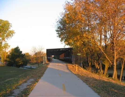
The MoPac Trail is a rail trail in Nebraska. It is a bicycling, equestrian and walking trail built on an abandoned Missouri Pacific Railroad corridor which runs for 26 miles (42 km) from Lincoln, Nebraska to Wabash, Nebraska.
Contents
Map of Mopac Trail, Lincoln, NE, USA
History
The corridor that is now the MoPac Trail was part of the Missouri Pacific Railroad's Omaha Belt Line until 1984. The 4-mile (6.4 km) portion of the MoPac Trail within the Lincoln city limits was purchased by the city in 1989. Two years later, an additional 22 miles (35 km) of former MP railway corridor was purchased by the Nebraska Trails Foundation and the Great Plains Trail Network; this portion of the trail is commonly referred to as the MoPac East Trail. The deed to this land was then transferred to the Lower Platte South Natural Resources District. The MoPac East section opened in 1994, and is part of the national American Discovery Trail network.
There are planned western and eastern extensions of the MoPac Trail. To the west, an extension will be built to connect it with other trails in the vicinity of the University of Nebraska–Lincoln campus. To the east, the MoPac will be connected with a trail extending south and west of Omaha. This planned extension will cross over the Platte River near South Bend, Nebraska. As of 2010, the portion from Springfield, NE on Nebraska Highway 50 is completed and extends southward towards to the Platte River. The bicycling and pedestrian bridge across the Platte River is complete, however the trail ends on the west side of the river. Therefore, the current gap in the trail is from near Wabash, NE to near South Bend, NE.
Trail guide
Communities along the MoPac Trail currently are (from west to east):
The west trailhead of the MoPac East section is located two blocks south of 84th and O Street in Lincoln. The westernmost six miles (9.7 km) of the trail are paved; the remainder is crushed limestone.