
Elevation 52 m (171 ft) Area 10.7 km² | State Berlin Founded 1920 Time zone CET/CEST (UTC+1/+2) | |
 | ||
Mitte (German for "middle, centre", commonly used without an article) is a central locality (Ortsteil) of Berlin in the homonymous district (Bezirk) of Mitte. Until 2001 it was itself an autonomous district.
Contents
Map of Mitte, Berlin, Germany
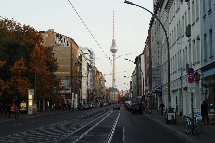
It comprises the historic centre of Alt-Berlin around the churches of St. Nicholas and St. Mary, renowned Museum Island, the city hall Rotes Rathaus, the city administrative building Altes Stadthaus, the famous Fernsehturm, Brandenburg Gate at the end of the central boulevard Unter den Linden and more main tourist attractions of the city. For these reasons Mitte is considered the "heart" of Berlin.
History
The history of Mitte corresponds to the history of the entire city until the early 20th century, and with the Greater Berlin Act in 1920 it became the first district of the city. It was among the areas of the city most heavily damaged in World War II.
Following a territorial redeployment by the Soviet Union and the United Kingdom that reshaped the borders of West Berlin's British Sector in August 1945, the western part of Staaken became in effect as of 1 February 1951 an exclave of Mitte, then still a borough of East Berlin. This ended on 1 January 1961, when western Staaken was incorporated into then East German Falkensee, which had already been under its de facto administration since 1 June 1952.
Between 1961 and 1990 Mitte, one of the most important boroughs of East Berlin but close to all three western sectors of the city, was almost surrounded by the Berlin Wall. One of the most important border crossings was Checkpoint Charlie, near Kreuzberg.
Position
Situated in central Berlin and mostly in its old town, it is traversed by the river Spree. It borders the localities of Tiergarten, Moabit, Wedding, Gesundbrunnen, Prenzlauer Berg (in Pankow district), Friedrichshain, and Kreuzberg (both in Friedrichshain-Kreuzberg district).
Subdivision
Mitte is subdivided into 13 zones or neighborhoods (Stadtviertel) (the numbers refer to the map above right):
Sister cities
Transportation
Mitte is served by S-Bahn lines S5, S7, S75, S9 (both on Berlin Stadtbahn); S1, S2, S25, and U-Bahn lines U2, U5, U6 and U8, as well as numerous tram and bus lines.