
Elevation 52 m (171 ft) Area 9.78 km² | State Berlin Founded 1920 Time zone CET/CEST (UTC+1/+2) | |
 | ||
Friedrichshain is a district of Berlin, Germany. From its creation in 1920 until 2001, it was a freestanding city borough. Formerly part of East Berlin, it is adjacent to Mitte, Prenzlauer Berg, Kreuzberg and Lichtenberg.
Contents
Map of Friedrichshain, Berlin, Germany
Friedrichshain is named after the Volkspark Friedrichshain, a vast green park at the northern border with Prenzlauer Berg. In the Nazi era, the borough was called Horst-Wessel-Stadt. Friedrichshain is one of the trendy districts of Berlin and has experienced gentrification.
Geography
Friedrichshain is defined by the following roads and places, starting clock-wise in the west: Lichtenberger Straße, Mollstraße, Otto-Braun-Straße, Am Friedrichshain, Virchowstraße, Margarete-Sommer-Straße, Danziger Straße, Landsberger Allee, Hausburgstraße, Thaerstraße, Eldenaer Straße, S-Bahn-Trasse, Kynaststraße, Stralauer Halbinsel, Spree.
History
The largely working-class district was created in 1920 when Greater Berlin was established by referendum, incorporating several surrounding settlements. Friedrichshain united the Frankfurter Vorstadt, already part of Berlin, and the villages of Boxhagen and Stralau. It took its name (meaning 'Frederick's Grove') from the Volkspark ('People's Park'), which was planned in 1840 to commemorate the centenary of Frederick the Great’s coronation. Much of the district was settled in the rapid industrialization of the 19th and early 20th centuries, led by growth in manufacturing and crafts. It owed much to the opening of the railway line between Berlin and Frankfurt (Oder) in 1846 (which terminated near the site of today's Berlin Ostbahnhof), and the opening of the first waterworks in 1865 at Stralauer Tor. In 1874 the Krankenhaus im Friedrichshain was opened, Berlin's first hospital beside the university clinic Charité. In the early 1900s, the district's largest employer was the Knorr-Bremse brake factory; the Knorrpromenade, one of Friedrichshain's most attractive streets, was built to house the management. The street network of Friedrichhain was originally specified in the Hobrecht-Plan and the area was part of what came to be known architecturally as the Wilhelmine Ring.
When the Nazis came to power in 1933, the district was renamed Horst-Wessel-Stadt after the Nazi activist and writer of the Nazi hymn whose slow death, after being shot by communists, in Friedrichshain hospital in 1930 was turned into a propaganda event by Joseph Goebbels.
During World War II Friedrichshain was one of the most badly damaged parts of Berlin, as Allied strategic bombers specifically targeted its industries. As late as the nineties, some buildings still displayed bullet holes from the intense house to house fighting during the Battle of Berlin. After the war ended, the boundary between the US and Soviet occupation sectors ran between Friedrichshain and Kreuzberg, with Friedrichshain in the east and Kreuzberg in the west. This became a sealed border between East and West Berlin when the Berlin Wall was built in 1961.
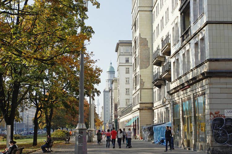
Stalinallee (previously Große Frankfurter Straße) was built in Friedrichshain in the late 1940s and early 1950s as a prestige project; the architecture of its 'workers' palaces' is strongly reminiscent of the ostentatious Soviet-era Moscow boulevards and is sometimes mockingly described as Zuckerbäckerstil ('wedding cake style'). The 1953 uprising had its origins in these construction projects, as increased work quotas led to protests that soon spread throughout East Germany, and were only put down by armed Soviet intervention.
In the period of De-Stalinization following the Soviet leader's death, the boulevard was renamed Karl-Marx-Allee at one end and Frankfurter Allee at the other. From this time onwards, Friedrichshain often featured on East Berlin's cultural map: in 1962 the Kosmos, East Germany's largest cinema, was opened, followed in 1981 by the country's most ambitious swimming and sports complex, the Sport- und Erholungszentrum. Neither of these buildings serve their original function today.
Lifestyle
In the course of the changes following the fall of the Berlin Wall in November 1989, the free elections in March 1990 and leading up to German reunification the following October, Friedrichshain began to develop a reputation as a young, dynamic district, thanks in part to low rents and the many empty apartments that also attracted the attention of squatters including many from former West Berlin. On 14 November that year, Friedrichshain experienced violent clashes when hundreds of squatters were forcefully evicted from houses in Mainzer Straße by police acting on the orders of the Senate of the recently united city, an act which would trigger the fall of the governing coalition when the Green Party withdrew in protest. In the following years further squatters were evicted under the hardline conservative Senator for the Interior, but others were able to buy the houses they lived in, and they remain a distinct (counter-)cultural influence in the district to this day.
Alongside the neighboring districts of Mitte, Prenzlauer Berg, and Kreuzberg, Friedrichshain is now considered one of Berlin's most fashionable areas, and is home to numerous design and media companies including MTV Central Europe. It is known for its many bars, clubs, pubs, and cafes, concentrated in the vicinity of Simon-Dach-Straße and Boxhagener Platz. There were numerous squats in Friedrichshain, with many in and around Rigaer Straße, Mainzer Straße and Scharnweber Straße. In contrast to the districts of Prenzlauer Berg and Mitte, which have experienced high levels of demographic change and rented accommodation is higher, it is only since the late 1990s that Friedrichshain has undergone a similar trend. Following German reunification, the availability of comparatively cheap rented accommodation attracted students and artists. Nowadays numerous restoration works are under way and Friedrichshain is developing at a fast pace becoming more and more gentrified itself.
At the opposite end of the district, the Volkspark Friedrichshain is a large park serving the densely populated area of Prenzlauer Berg on the other side. Its distinctive features include the Märchenbrunnen (Fairytale Fountain) and two green and pleasant "mountains" consisting purely of rubble and the ruins of two World War II Flak towers.
Peaceful green oases like the Volkspark Friedrichshain offer opportunities for sports and recreation in leafy nature. The Spreeufer is lovely for walks along the riverside. Concerning its culinary offerings, this area also boasts a great choice of restaurants in all price ranges as well as many charming cafés. Culture lovers enjoy this neighborhood because of various small exhibition spaces, venues, cinemas and the Berlin Kriminal Theater that specializes in crime stories. Frankfurter Allee features various shopping facilities as well as the Ring-Center shopping mall.