
Length 151.3 km | ||
 | ||
Major cities Mountain Grove, Wasola, Thornfield, Vanzant, Manes, Drury, Lynchburg, Longrun, Gentryville, Almartha, Lutie | ||
Route 95 is a highway in southern Missouri. Its northern terminus is at Route 32 at Lynchburg in Laclede County. Its southern terminus is at U.S. Route 160 at Lutie about 2.5 miles west of the Theodosia arm of Bull Shoals Lake in Ozark County.
Contents
Map of MO-95, Missouri, USA
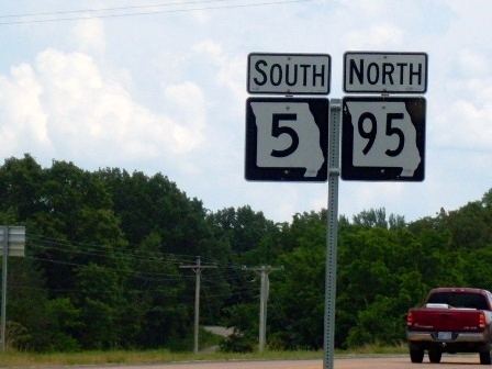
A short 3.3 miles (5.3 km) section forms a wrong-way concurrency with Route 5; Route 95 is marked as "North Route 95" but goes south at this location.
History
The section of Route 95 north of Wasola to Lutie was originally a section of Route 5A, a branch of Route 5.
References
Missouri Route 95 Wikipedia(Text) CC BY-SA