
Existed: 1933 – present Length 556.8 km | Constructed 1933 | |
 | ||
Minnesota State Highway 1 (MN 1) is a highway in northwest and northeast Minnesota, which runs from North Dakota Highway 54 at the North Dakota state line (at the Red River in Oslo) and continues east to its eastern terminus at its intersection with Minnesota Highway 61 at the unincorporated community of Illgen City in Beaver Bay Township on the North Shore of Lake Superior. At 346 miles (557 km) in length, Highway 1 is the longest state route in Minnesota.
Contents
Map of MN-1, Minnesota, USA
Route description
State Highway 1 serves as an east–west route between Oslo, Warren, Thief River Falls, Red Lake, Northome, Cook, Tower, Ely, and Beaver Bay Township.
The roadway passes through the following forests:
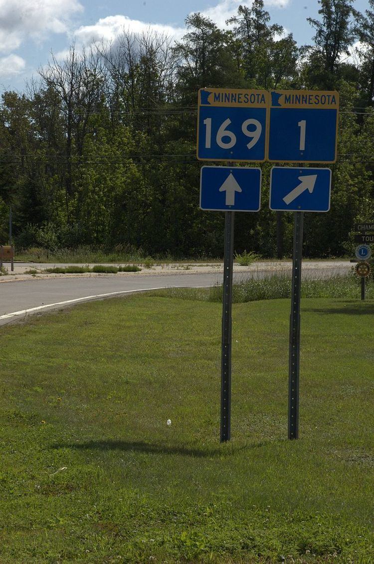
The route runs concurrent with State Highway 169 for 26 miles (42 km) from Vermilion Lake Township (west of Tower) to Ely.
State Highway 1 also runs concurrent with State Highway 89 for 28 miles (45 km) on the southwest side of Red Lake. This is the longest concurrency with another state highway within Minnesota.
History
Most of State Highway 1 was authorized in 1933, except for a section between U.S. 75 and State Highway 32 at Thief River Falls which was part of Minnesota Constitutional Route 33 authorized in 1920.
The route was given the Highway 1 designation because it was one of the longest trunk highways, and would allow re-use of the Route 1 markers removed from along U.S. 61 and U.S. 65 in 1934.
When it was marked in 1934, it was only paved from U.S. 75 to Highway 32 and from Highway 169 to Ely.
As recently as 1963, significant portions of Highway 1 were unpaved.
Highway 1 still had an unpaved segment in 1996, between U.S. 53 and State Highway 169 in northern Saint Louis County. At that point it was swapped with paved Saint Louis County Road 22.