Samiksha Jaiswal (Editor)

Mimasaka, Okayama

Updated on
Edit
Like
Comment
Share on FacebookTweet on TwitterShare on LinkedInShare on Reddit
Country
  
Area
  
429.2 km²

Local time
  
Monday 3:46 AM

Region
  
Chūgoku (San'yō)

Population
  
30,019 (1 Nov 2011)

Prefecture
  
Mimasaka, Okayama www10plalaorjpCOOLMOONmieaimagesImage4gif

Time zone
  
Japan Standard Time (UTC+9)

City hall address
  
38-2 Sakaemachi, Mimasaka-shi, Okayama-ken707-8501

Website
  
www.city.mimasaka.lg.jp

Weather
  
2°C, Wind NE at 3 km/h, 88% Humidity

Points of interest
  
Komanooyama, Bell Peel Natural Park, Kuga Dam, Anyō-ji Temple, Magiyama, Uneyama, Sugisaka Pass

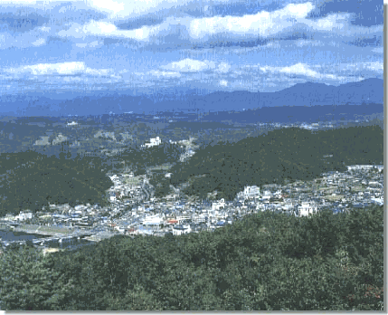
Mimasaka (美作市, Mimasaka-shi) is a city located in Okayama Prefecture, Japan.

Contents

Map of Mimasaka, Okayama Prefecture, Japan

As of November 1, 2011, the city has an estimated population of 30,019 (34,338 in 2004) and a population density of 70 persons per km². The total area is 429.19 km².

History

The 16th century village Miyamoto, considered the birthplace of Miyamoto Musashi, is part of present-day Mimasaka.

The modern city of Mimasaka was founded on March 31, 2005 by the merger of the former town of Mimasaka, absorbing the towns of Aida, Ōhara and Sakutō, the village Higashiawakura (all from Aida District), and the town of Katsuta (from Katsuta District).

Geography

  • Mountains:Mount Ushiro (The highest mountain in Okayama Prefecture)
  • Rivers:Yoshino River, Kajinami River
  • Adjoining municipalities

  • Okayama Prefecture
  • Bizen
  • Wake
  • Misaki
  • Shōō
  • Nagi
  • Nishiawakura
  • Hyōgo Prefecture
  • Shisō
  • Sayō
  • Tottori Prefecture
  • Chizu
  • Railways

  • West Japan Railway Company
  • Kishin Line
  • Mimasaka-Doi Station - Mimasaka-Emi Station - Narahara Station - Hayashino Station
  • Chizu Express
  • Chizu Line
  • Miyamoto Musashi Station - Ōhara Station
  • Road

  • Expressways:
  • Chūgoku Expressway
  • Sakutō Interchange - Narahara Parking Area - Mimasaka Interchange
  • National highways:
  • Route 179
  • Route 373
  • Route 374
  • Route 429
  • Main prefectural roads:
  • Okayama Prefectural Route 5 (Sakutō-Ōhara)
  • Okayama Prefectural Route 7 (Chizu-Katsuta)
  • Okayama Prefectural Route 46 (Wake-Sasame-Sakutō)
  • Okayama Prefectural Route 51 (Mimasaka-Nagi)
  • Okayama Prefectural Route 86 (Sakutō Interchange)
  • Okayama Prefectural Route 90 (Akō-Saeki)
  • Sister and Friendship cities

  • Former Ōhara town
  • Neyagawa, Osaka, Japan - Friendship city agreement concluded in 1991
  • Echizen (Former Imadate town), Fukui, Japan - Sister city agreement concluded in 1990
  • Former Sakutō town
  • Saint-Valentin, France - Sister city agreement concluded in April 6, 1988
  • Sankt Valentin, Austria - Sister city agreement concluded in October 25, 1994
  • Saint-Valentin, Canada - Sister city agreement concluded in October 24, 1997
  • Notable places and events

  • Miyamoto Musashi Budokan
  • Yunogo Onsen
  • Okayama International Circuit
  • Village of Miyamoto Musashi
  • Ōhara-shuku (Shukuba)
  • Valentine Park Sakutō
  • Chōfukuji Temple
  • Japan museum of contemporary toy & Hall of music box
  • Notable people from Mimasaka

  • Miyamoto Musashi
  • Tomoji Abe
  • Doshin So
  • Atsuko Asano
  • References

    Mimasaka, Okayama Wikipedia