
Length 167 km | Country United States of America | |
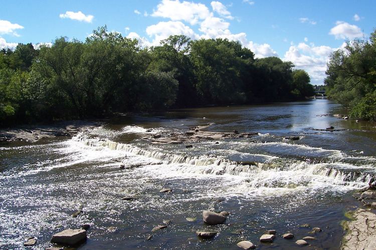 | ||
Source Fond du Lac County, Wisconsin | ||
Ben s tours milwaukee river cruise
The Milwaukee River is a river in the state of Wisconsin. It is about 104 miles (167 km) long. Once a locus of industry, the river is now the center of a housing boom. New condos now crowd the downtown and harbor districts of Milwaukee attracting young professionals to the area. The river is also ribboned with parks as it winds through various neighborhoods. Kayaks and fishing boats share the river with party boats. An extensive Riverwalk featuring art displays, boat launches and restaurants lines its banks in downtown Milwaukee.
Contents
- Ben s tours milwaukee river cruise
- Map of Milwaukee River Wisconsin USA
- DescriptionEdit
- WatershedEdit
- HistoryEdit
- BridgesEdit
- ParksEdit
- DamsEdit
- References
Map of Milwaukee River, Wisconsin, USA
DescriptionEdit
The river begins in Fond du Lac County, Wisconsin and flows south past Grafton to downtown Milwaukee, where it empties into Lake Michigan. Cedar Creek, the Menomonee River and the Kinnickinnic River are the three main tributaries.
WatershedEdit
The Milwaukee River watershed drains 882 square miles (2,280 km2) in southeastern Wisconsin, including parts of Dodge, Fond du Lac, Milwaukee, Ozaukee, Sheboygan, Washington and Waukesha counties.
The Milwaukee River watershed is part of the Lake Michigan subbasin; this subbasin is itself a part of the St. Lawrence River Watershed, which is fed by the Great Lakes.
HistoryEdit
The Milwaukee River area was populated by Native Americans in the time before European settlement. Jacques Marquette and Louis Jolliet navigated from Lake Michigan through the Milwaukee River on their way to the Fox River and the Mississippi.
In the early 19th century, three towns were formed across the banks of the Milwaukee and Kinnickinnic rivers: Juneautown by Solomon Juneau, Walker's Point by George H. Walker and Kilbourntown by Byron Kilbourn. The quarrel over the formation of a bridge across the Milwaukee River was a key point in the merging of the three towns into the city of Milwaukee in 1846.
BridgesEdit
The Milwaukee River has numerous movable bridges spanning it, allowing for pedestrian and vehicular traffic. These bridges include several different types, including bascule and vertical lift bridges. There are also many fixed bridges, as well as several pedestrian-only and railroad trestles.
The following is a partial list of bridges that cross the river, from north to south:
There are also several Union Pacific (former Chicago and North Western Railway) railroad bridges crossing the Milwaukee River, including:
ParksEdit
There are several parks on the banks of the Milwaukee River. These include Gordon, Kern, Lincoln, Pere Marquette, Pleasant Valley, and Riverside Parks in Milwaukee, Kletzsch Park in Glendale, as well as Hubbard Park and Estabrook Park in Shorewood.
DamsEdit
There are also several dams along the river. The dam in Estabrook Park, Milwaukee County is currently the subject of controversy. Some nearby residents want it rebuilt. The State of Wisconsin and local environmental advocacy groups like the Milwaukee River keepers want it removed.