
Country United States County Fulton Time zone EST (UTC-5) Elevation 298 m Population 35,907 (2013) | Incorporated December 1, 2006 ZIP codes 30004, 30009 Area 101.4 km² Local time Wednesday 8:34 PM | |
 | ||
Weather 14°C, Wind W at 8 km/h, 32% Humidity Neighborhoods Alpharetta Woods, Wyndham Farms, Wood Valley | ||
Take a tour of alpharetta and milton georgia
Milton is a city and suburb in Fulton County, Georgia, United States. Incorporated on December 1, 2006, it was created out of the entire unincorporated northernmost part of northern Fulton County. It is an affluent community, with an average household income within the ZIP code 30004 of $99,412. As of the 2010 census, Milton's population was 32,661, with an estimated population of 36,662 in 2014.
Contents
- Take a tour of alpharetta and milton georgia
- Map of Milton GA USA
- Incorporation
- Geography
- Major highways
- Demographics
- Officials
- Education
- References
Map of Milton, GA, USA
Milton is named in honor of the former Milton County, which was named after Revolutionary War hero John Milton. The portion of north Fulton County generally north of the Chattahoochee River comprises most of the territory of the former Milton County.
Incorporation
A citizens' committee was formed in 2005 to help determine the viability of incorporating unincorporated northern Fulton County. After debate, the Georgia State House and Senate approved a bill creating the city of Milton on March 9, 2006. On March 28, Governor Sonny Perdue signed the bill into law. In July 2006, voters approved a ballot referendum on July 18 by more than 86%. On August 4, 2006, Governor Perdue appointed a five-person commission to serve as the interim government of Milton. Milton adopted the existing county ordinances on December 1, 2006.
Geography
Milton occupies the northern tip of Fulton County and is centered at 34°7′56″N 84°18′2″W (34.1321631, -84.3006660). It is bounded by the cities of Roswell and Alpharetta on the south, Forsyth County on the east, and Cherokee County on the north and west. Former communities within Milton's city limits include Birmingham, Field's Cross Roads, and Crabapple. The Arnold Mill is located on Georgia State Route 140 (Arnold Mill Road). Downtown Atlanta is 31 miles (50 km) to the south.
According to the U.S. Census Bureau, the city of Milton has a total area of 39.2 square miles (101.4 km2), of which 38.5 square miles (99.8 km2) is land and 0.62 square miles (1.6 km2), or 1.59%, is water. The elevation ranges from 950 to 1,280 feet (290 to 390 m) above sea level.
As of April 2007, the US Postal Service recognizes Milton as a valid alias for ZIP code 30004, which is served from the Alpharetta post office.
Major highways
Demographics
According to the Census Bureau's 2010 preliminary figures, the population of Milton is 32,661. The city is 76.6% white, 10.4% Asian (6.9% Asian Indian, 1.2% Chinese, 0.6% Korean, 0.4% Filipino, 0.4% Pakistani, 0.2% Vietnamese, 0.1% Japanese, 0.1% Indonesian, 0.1% Bangladeshi), 9.0% black or African American, 6.0% Hispanic or Latino of any race (2.1% Mexican, 0.8% Puerto Rican, 0.7% Colombian, 0.5% Cuban, 0.3% Venezuelan, 0.3% Peruvian, 0.2% Argentinean, 0.2% Spaniard), and 0.2% Native American.
The vast majority of Milton is part of the ZIP code 30004, which has an average household income of $99,412.
Officials
Education
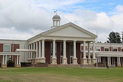
The city is served by Fulton County Schools
Elementary schools (grades K-5):
Middle schools (grades 6-8):
High schools (grades 9-12):
Private schools: