
FIPS code 19-52410 Elevation 191 m Zip code 52052 Population 29 (2013) | Time zone Central (CST) (UTC-6) GNIS feature ID 0459117 Area 18 ha Local time Wednesday 4:38 PM Area code 563 | |
 | ||
Weather 5°C, Wind SE at 13 km/h, 27% Humidity | ||
Millville is an unincorporated town in Clayton County, Iowa, United States. The population was 30 at the 2010 census, up from 23 at the 2000 census.
Contents
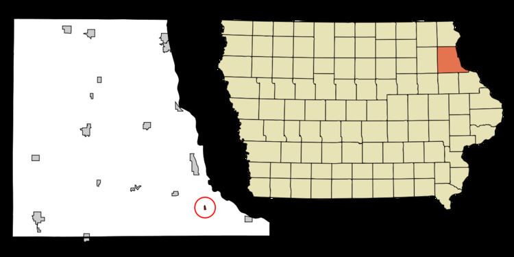
Map of Millville, IA, USA
History
The city of Millville was incorporated in 1967 along the Turkey River. Located on US Highway 52 the city limits is only 0.76 miles long. In late 2013, early 2014 the city of Millville disincorporated due to a population decrease.
Millville is best known for the Millville Poltergeist that shook the small sub-division of Guttenberg in 1960. <http://www.prairieghosts.com/millville.html>
Unincorporation
In October 2013, the city started undergoing the process of unincorporating itself, and formally became unincorporated in July 2014.
Geography
Millville is located at 42°42′15″N 91°4′34″W (42.704250, -91.076026).
According to the United States Census Bureau, the city has a total area of 0.07 square miles (0.18 km2), all of it land.
2010 census
As of the census of 2010, there were 30 people, 12 households, and 9 families residing in the city. The population density was 428.6 inhabitants per square mile (165.5/km2). There were 12 housing units at an average density of 171.4 per square mile (66.2/km2). The racial makeup of the city was 100.0% White.
There were 12 households of which 25.0% had children under the age of 18 living with them, 58.3% were married couples living together, 16.7% had a male householder with no wife present, and 25.0% were non-families. 16.7% of all households were made up of individuals. The average household size was 2.50 and the average family size was 2.78.
The median age in the city was 38 years. 23.3% of residents were under the age of 18; 13.3% were between the ages of 18 and 24; 23.4% were from 25 to 44; 20% were from 45 to 64; and 20% were 65 years of age or older. The gender makeup of the city was 56.7% male and 43.3% female.
2000 census
As of the census of 2000, there were 23 people, 10 households, and 8 families residing in the city. The population density was 342.6 people per square mile (126.9/km²). There were 11 housing units at an average density of 163.9 per square mile (60.7/km²). The racial makeup of the city was 100.00% White.
There were 10 households out of which 20.0% had children under the age of 18 living with them, 80.0% were married couples living together, and 20.0% were non-families. 20.0% of all households were made up of individuals and none had someone living alone who was 65 years of age or older. The average household size was 2.30 and the average family size was 2.63.
In the city, the population was spread out with 21.7% under the age of 18, 17.4% from 25 to 44, 34.8% from 45 to 64, and 26.1% who were 65 years of age or older. The median age was 56 years. For every 100 females there were 76.9 males. For every 100 females age 18 and over, there were 100.0 males.
The median income for a household in the city was $29,583, and the median income for a family was $29,583. Males had a median income of $6,250 versus $27,500 for females. The per capita income for the city was $14,378. None of the population and none of the families were below the poverty line.