
Type Reservoir Basin countries United States Max. depth 319 ft (97 m) Area 19.83 km² | Primary inflows Surface area 4,900 acres (2,000 ha) Surface elevation 171 m Catchment area 4,338 km² Parent range Sierra Nevada | |
 | ||
Outflow location Madera Canal, Friant-Kern Canal, San Joaquin River | ||
Bass bluegills fishing at millerton lake ca
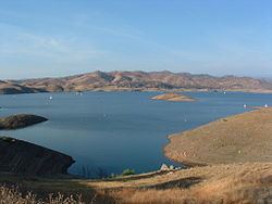
Millerton Lake is an artificial lake near the town of Friant about 15 mi (24 km) north of downtown Fresno. The reservoir was created by the construction of Friant Dam on the San Joaquin River which with the lake serves as much of the county line between Fresno County to the south and Madera County to the north.
Contents
- Bass bluegills fishing at millerton lake ca
- Map of Millerton Lake California 93626 USA
- Sky harbour table tops millerton lake ca
- Environmental impactsEdit
- References
Map of Millerton Lake, California 93626, USA
Part of the Central Valley Project, the dam was built by the United States Bureau of Reclamation and was completed in 1942. The lake stores water for irrigation, which is distributed by the Madera and Friant-Kern Canals to the San Joaquin Valley. It has a capacity of 520,528 acre·ft (0.642062 km3).
Secondary uses include flood control and recreation, including swimming, fishing, water skiing and camping. A 25 MW hydroelectric plant operated by the Friant Power Authority produces electricity from large releases and two smaller plants use water released for a fish hatchery and to maintain minimum-flow in the river.
Prior to the construction of Friant Dam, the current lake bed was the site of the town of Millerton, the first county seat of Fresno County.
Sky harbour table tops millerton lake ca
Environmental impactsEdit
By diverting most of the San Joaquin River for irrigation, the Friant Dam has caused about 60 miles (97 km) of the river to run dry except in high water years when floodwaters are spilled from the dam. The desiccation of the river has caused the degradation of large stretches of riverside habitat and marshes, and has nearly eliminated the historic chinook salmon run that once reached about 15,000 fish each year. Reduction in flows has also increased the concentration of pesticide and fertilizer runoff in the river contributing to pollution that has further impacted aquatic species.
On September 13, 2006, after eighteen years of litigation, environmental groups, fisherman and the USBR reached an agreement on releasing part of the water currently diverted into the irrigation canals into the San Joaquin River in order to help restore the river and its native fish and wildlife. The first water was released on October 2, 2009 at a rate of 185 cubic feet per second (5.2 m3/s). By 2014, these "restoration flows" will be increased to 302,000 acre feet (373,000 dam3) per year, or 417 cubic feet per second (11.8 m3/s), on top of the 117,000 acre feet (144,000 dam3) that is currently released for agricultural purposes. However, the river restoration project will cause a 12–20% reduction in irrigation water delivered from Friant Dam.