
Hangul 군사분계선 / 휴전선 | Hanja 軍事分界線 / 休戰線 | |
 | ||
Revised Romanization Gunsabungyeseon / Hyujeonseon McCune–Reischauer Kunsabungyesŏn / Hyujŏnsŏn | ||
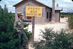
Crossing the military demarcation line in korea
The Military Demarcation Line (MDL), sometimes referred to as the Armistice Line, is the 154 mile-long land border or demarcation line between North Korea and South Korea. On either side of the line is the Korean Demilitarized Zone (DMZ). The MDL and DMZ were established by the Armistice at the end of the Korean War in 1953.
Contents
- Crossing the military demarcation line in korea
- Soldier speaking at the military demarcation line
- Demarcation on land
- Military incidents
- Northern Limit Line
- References
In the Yellow Sea, the two Koreas are divided by a de facto maritime "military demarcation line" and maritime boundary called the Northern Limit Line (NLL) drawn by the United Nations Command in 1953. The NLL is not described by the Korean Armistice Agreement.
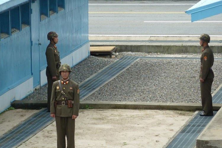
Soldier speaking at the military demarcation line
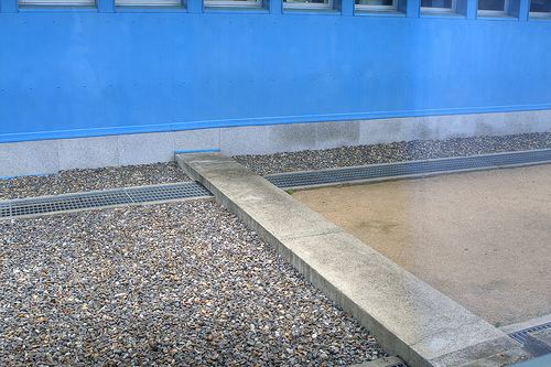
Demarcation on land
The DMZ runs near the 38th parallel, covering roughly 248 kilometers. American and South Korean soldiers patrol this line along the South Korean side while North Korean soldiers patrol along the North Korean side.
In Korean, the line is called the Hyujeonseon (휴전선), meaning "armistice line." It is also sometimes called the Gunsa Bungye-seon (군사분계선), which literally means "military demarcation line." However, in colloquial usage, the dividing line is more often called the Sampalseon (삼팔선, "38th parallel"), a name likely coined at the end of World War II, when it would have been an accurate description of the North-South border.
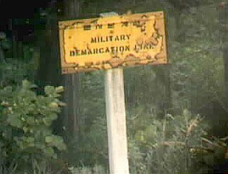
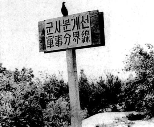
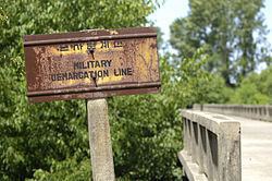
The line itself is marked off by a series of 1,292 identical signs which are placed at intervals across the peninsula. The north facing side of the signs are written in Korean and Chinese, and in Korean and English on the south facing side. The signs are now aging and rusting.
Military incidents
There have been frequent skirmishes along the line since the armistice ended the fighting of the Korean War.
Northern Limit Line
Although the Korean Armistice Agreement specifies where the demarcation line and demilitarized zone are located on land, the agreement does not mention lines or zones in adjacent ocean waters. Shortly after the signing of the Armistice, a line in the sea was drawn unilaterally by the United Nations Command (UNC). This Northern Limit Line or North Limit Line (NLL) represented the northern limit of the area in which South Korea permits its vessels to navigate, not a demarcation line on which the two Koreas agreed. The Korean Armistice Agreement (KAA) provisions regarding the MDL and DMZ do not extend into the Yellow Sea or Sea of Japan.
In 1999, North Korea unilaterally asserted its own "North Korean Military Demarcation Line in the West Sea (Yellow Sea)", also called the "Inter-Korean MDL in the Yellow Sea".
Nonetheless, the UNC-drawn line functions as a de facto or "practical" extension of the 1953 MDL, despite occasional incursions and clashes.