
Settled 1639 Population 53,137 (2013) Area code Area code 203 | State Connecticut Region South Central Region Local time Wednesday 8:04 AM Mayor Benjamin G. Blake (D) | |
 | ||
Weather 3°C, Wind NW at 26 km/h, 49% Humidity | ||
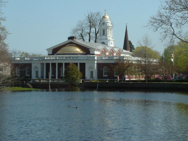
Milford is a coastal city in southwestern New Haven County, Connecticut, United States, located between Bridgeport and New Haven. The population was 52,759 at the 2010 census. The city contains the incorporated borough of Woodmont and the unincorporated village of Devon.
Contents
- Map of Milford CT USA
- Early history
- Towns created from Milford
- The oatmeal lots of Liberty Park
- Post World War II development
- Government
- Taxes
- Elected positions
- List of mayors
- Education
- High Schools
- Middle Schools
- Elementary Schools
- Technical Schools
- Private Schools
- Former Schools
- Fire Department
- Fire station locations and apparatus
- Police department
- Principal communities of Milford
- Culture
- Top employers
- Geography and environment
- Islands and coastline
- Transportation
- Demographics
- On the National Register of Historic Places
- Notable people
- Movies filmed in Milford
- References
Map of Milford, CT, USA
Early history
The land which today comprises Milford, Orange and West Haven was purchased on February 1, 1639 from Ansantawae, chief of the local Paugussets (an Algonquian tribe) by English settlers affiliated with the contemporary New Haven Colony. Originally, the area was known as "Wepawaug", after the small river which runs through the town, and which has given its name to several streets in both Milford and Orange.
A grist mill was first built over the Wepawaug River in 1640.
During the Revolutionary War the Milford section of the Boston Post Road, a vital route connecting Boston, New York and other major coastal cities, was blockaded by Continental forces, and Fort Trumbull was constructed to protect the town. The site of the blockade is commemorated by the Liberty Rock monument.
By 1822, the town had grown large enough that residents in the northern and eastern sections of Milford chartered their own independent course as the town of Orange. During the next century and a half, the remaining section of Milford was known for shipbuilding, farming and oystering, although a small subset of industrial facilities also developed in town. During this time, Milford also became known as a beach resort for residents of New Haven and Bridgeport.
Interestingly, the boundaries of the final town charter granted by the State of Connecticut in 1899 to Laurel Beach are contained entirely within Milford. Residents of Laurel Beach must therefore pay taxes to both Laurel Beach as well as Milford, and all mail to Laurel Beach residents is mailed to Milford.
Also in 1899, the "Memorial Bridge" (a "stone bridge and tower commemorating the town's history and founders") was built at the site of the last mill over the Wepawaug after it was closed in 1894. "The stone bridge is simple in design, its broad copings surmounted with rough hewn blocks of granite, bearing the names of the first settlers. There are ten blocks on the south and twenty on the north coping. At each end of the former is a stone four feet wide by five and a half high." It is located where Broad Street crosses the Wepawaug River.
In 1903, the southeastern portion of the town was incorporated as the Borough of Woodmont. In 1959, the town of Milford including the Borough of Woodmont was incorporated as the City of Milford.
Towns created from Milford
Milford was one of the early settlements in south central Connecticut and, over time, gave rise to several new towns that broke off and incorporated separately. The following is a list of towns created from parts of Milford.
The "oatmeal lots" of Liberty Park
Starting in 1902, Quaker Oats oatmeal boxes came with a coupon redeemable for the legal deed to a tiny lot in Milford. The lots, sometimes as small as 10 feet (3 m) by 10 feet, were carved out of a 15-acre (6.1 ha) tract in a never-built subdivision called "Liberty Park". A small number of children (or their parents), often residents living near Milford, collected the deeds and started paying the extremely small property taxes on the "oatmeal lots". The developer of the prospective subdivision hoped the landowners would hire him to build homes on the lots, although several lots would need to be combined before building could start. Since the subdivision into small lots predated Milford's planning and zoning regulations, the deeds were entirely legal, although they created a large amount of paperwork for town tax collectors, who frequently couldn't find the property owners and received almost no tax revenue from the lots.
In the mid-1970s, when the town wanted to develop the area, town officials put an end to the oatmeal lots in a "general foreclosure" that avoided the enormous expense of individual foreclosures by condemning nearly all of the property in one legal filing. One of the streets in the Liberty Park subdivision plans, Shelland Street, was later built in the late 1990s as an access road to the Milford Power Company. The site is currently home to the BIC Corporation's lighter factory at 565 Bic Drive. (In a separate land giveaway in 1955 tied to the Sergeant Preston of the Yukon television show, Quaker Oats offered in its Puffed Wheat and Puffed Rice cereal boxes genuine deeds to land in the Klondike.)
Post-World War II development
In the post-World War II period, Milford—like many Connecticut towns—underwent significant suburbanization. Interstate 95 was routed through town, and the Milford section was completed in 1958.
The 1960s and 1970s witnessed the construction of the Connecticut Post Mall, one of the state's largest shopping malls, and the extensive commercial development of the town's stretch of the Boston Post Road. One notable small business located on the Boston Post Road during the 1970s was SCELBI Computer Consulting, credited by many as being the world's first personal-computer manufacturer. Starting in 1975, the city began hosting the Milford Oyster Festival, which has since become firmly established as an annual Milford tradition that is held "rain or shine".
The city became host to several headquarters of multinational corporations, including the Schick Shaving company, and Doctor's Associates, Inc., owners of the Subway chain of fast-food restaurants. The US operations of BIC were headquartered in Milford, but in March 2008 moved most of its operations to Shelton. Milford Hospital has also developed into an important health care resource for the area. It has also become home of smaller national corporations such as K-Mart and Orchid Medical.
Government
Government in the city is set up with the mayor as chief executive and the Board of Aldermen as a legislative body. The mayor is permitted to propose legislation to the Board of Aldermen and introduces the city budget, but possesses no veto power over what the Aldermen chooses to pass.
Taxes
In 2005, the mill rate for Milford was 34.36 and is 27.88 mills for fiscal year 2015–2016.
Elected positions
The following is a list of city government positions elected by city residents and the terms thereof:
List of mayors
After becoming incorporated as a city in 1959, the city reformed its system of government by establishing a mayor–board of aldermen format. It elected its first mayor, Charles Iovino, the incumbent city manager under Milford's previous form of government, on November 3, 1959.
Since 1959, 10 people have held the office of mayor in the city.
Education
Milford public schools currently operates eight Elementary schools, three Middle schools, two High schools, and one Alternative Education High school. There are also a number of private schools in the city.
High Schools
Middle Schools
Elementary Schools
Technical Schools
Private Schools
Former Schools
Fort Trumbull school
Fire Department
The city of Milford is protected 24/7, 365 by the 114 paid, full-time firefighters of the city of Milford Fire Department - ISO Class 1. The Milford Fire Department currently operates out of five fire stations, located throughout the city, under the command of a Battalion Chief and a Shift Commander. The Milford Fire Department also maintains and operates a fire apparatus fleet of six engines (including two Quints), one tower ladder, three rescue ambulances, one HazMat unit, one dive rescue unit, one collapse rescue unit, two fireboats, a canteen unit, and numerous other special, support, and reserve units. The Milford Fire Department is one of only two fire departments in the state of Connecticut to maintain an ISO Class 1 rating. The current Fire Chief is Douglas Edo.
Fire station locations and apparatus
Below is a complete listing of all fire station locations and apparatus in the city of Milford.
The Milford Fire Department also operates four reserve engines. Engine 2 (Reserve) is located at the quarters of Engine 1 and Tower 1. Engines 8 and 10 (Reserve) are located at the quarters of Engine 3 (Quint) and Engine 4, while Engine 9 (Reserve) is located at the quarters of Engine's 5 and 6. The Canteen Unit is operated out of a garage at 3 Charles Street.
Police department
The Milford Police Department is led by Chief Keith L. Mello, a 1981 graduate of the town's police academy. On May 12, 2011, the Police Officer Standards & Training Council re-accredited the department's Tier I & II State Accreditation.
Principal communities of Milford
Other minor communities and geographic features are Anchor Beach, Bayview Heights, Burwells Beach, Cedar Beach, Downtown Historic District, Ettadore Park, Far View Beach, Forest Heights, Fort Trumbull, Great River, Gulf Beach, Laurel Beach, Lexington Green, Merwin's Beach, Merwin's Point, Milford Lawns, Milford Point, Myrtle Beach, Naugatuck Gardens, Point Lookout, Silver Sands Beach, South of the Green, Walnut Beach, Wheelers Farms.
†denotes that the community is chartered by Special Act of the Connecticut General Assembly and have been granted some of the powers normally held only by a municipality including taxing authority. ‡The Borough of Woodmont is chartered by Special Act of the Connecticut General Assembly as a municipality and has been granted all statutory powers of an municipality while simultaneously remaining part of the city of Milford.
Culture
Every year on the third Saturday in August, Milford celebrates its annual Oyster Festival, which serves as a combination of a typical town fair with a culinary celebration of the town's location on historically shellfish-rich Long Island Sound. This festival takes place in and around the Milford Green, near the center of town, as well as in various locations throughout the downtown area, and features a wide variety of events including canoe and kayak races, musical performances, and classic car shows.
The Milford Oyster Festival has drawn large musical acts over the years including Joan Jett, The Marshall Tucker Band, John Cafferty & The Beaver Brown Band, Soul Asylum, and many more.
There are also other features such as carnival rides, food stands, crafts, face painting, and even opening your own oyster for a pearl.
The Milford Cultural Center, operated by the Milford Council for the Arts, offers various events throughout the year. The Firehouse Art Gallery was recently opened in Devon. The beach resort quality of the town lives on, with several rocky beaches, Silver Sands State Park, the Connecticut Audubon Society Coastal Center at Milford Point, Charles Island, two golf courses, and numerous other recreational facilities available for residents and tourists.
Starting in 2011, the Walnut Beach Concert Series has taken place under the pavilion at Walnut Beach. It features a different band playing every Sunday afternoon during the summer.
Top employers
According to the City's 2013 Comprehensive Annual Financial Report, the top employers in the city are:
Geography and environment
According to the United States Census Bureau, Milford, including the borough of Woodmont, has a total area of 26.1 square miles (67.7 km2), of which 22.2 square miles (57.4 km2) is land and 3.9 square miles (10.2 km2), or 15.11%, is water.
Milford's Devon neighborhood is located at the mouth of the Housatonic River near Stratford, and features the Connecticut Audubon Coastal Center overlooking the estuary.
Islands and coastline
Milford has over 14 miles (23 km) of shoreline facing Long Island Sound, the most of any town in Connecticut. A large portion of Milford's shoreline forms the Silver Sands State Park. A newly built 3/4 mile boardwalk was opened in 2011 that connects Silver Sands to Walnut Beach in Devon. Charles Island is also a part of the park and is a protected bird nesting ground. There is a sand bar (called a tombolo since it is perpendicular, not parallel to the coast) accessible during low tide that people can walk on from Silver Sands Beach to Charles Island.
The island is a part of the Hamonasset-Ledyard Moraine and was formed as glaciers retreated at the end of the last ice age. The Wisconsin glaciation formed drumlins in Milford: Clark, Burwell, Eels, Bryan and Merwin hills.
Milford owns three islands in the Housatonic River: Fowler Island, just to the south of the Igor I. Sikorsky Memorial Bridge, Duck Island, and Nells Island, both near the mouth of the river. In addition to Silver Sands State Park, Milford has five public beaches with lifeguard services for its residents - Gulf Beach, Anchor Beach, Hawley Avenue Beach, Walnut Beach, and Middle Beach - as well as seven private beaches.
Transportation
Interstate 95 and U.S. Route 1 pass through the southern part of Milford. The Wilbur Cross Parkway cuts across the northern part of the city and is connected to I-95 and Route 1 via the Milford Parkway, also known as the Daniel S. Wasson connector, named for the first police officer to die in the line of duty in the city of Milford. He was killed on April 12, 1987, when he was shot by a motorist he had pulled over. The Metro-North New Haven Line has a station stop in downtown Milford (Milford station). The Milford Transit District provides in-town service to major attractions. Connections with the Greater Bridgeport Transit Authority and Connecticut Transit New Haven are also available.
Demographics
As of the census of 2000, there were 52,212 people, 20,138 households, and 13,613 families residing in Milford. The population density was 2,270.7 people per square mile (876.8/km2). There were 21,145 housing units at an average density of 949.0 per square mile (366.4/km2). The racial makeup of Milford was 93.55% White, 1.91% African American, 0.13% Native American, 2.36% Asian, 0.03% Pacific Islander, 0.88% from other races, and 1.14% from two or more races. Hispanic or Latino of any race were 3.34% of the population.
There were 20,138 households out of which 29.3% had children under the age of 18 living with them, 54.7% were married couples living together, 9.7% had a female householder with no husband present, and 32.4% were non-families. 26.3% of all households were made up of individuals and 10.3% had someone living alone who was 65 years of age or older. The average household size was 2.49 and the average family size was 3.04.
In Milford the population was spread out with 22.4% under the age of 18, 5.9% from 18 to 24, 31.7% from 25 to 44, 25.0% from 45 to 64, and 14.9% who were 65 years of age or older. The median age was 39 years. For every 100 females there were 93.6 males. For every 100 females age 18 and over, there were 90.0 males.
As of the 2000 census, the median income for a household was $61,183. The per capita income was $28,773. About 2.4% of families and 3.8% of the population were below the poverty line, including 4.1% of those under age 18 and 5.4% of those age 65 or over.
The Census Bureau's 2010–2012 American Community Survey showed that (in 2012 inflation-adjusted dollars) median household income was $77,925 and the median family income was $93,697. Year-round male workers had a median income of $67,631 versus $59,992 for females. The per capita income for the city was $38,560.
On the National Register of Historic Places
Notable people
Movies filmed in Milford
Movies filmed at least in part in Milford include: