
- Tree Weeping Cherry blossom | Population 17,254 (Dec 2014) | |
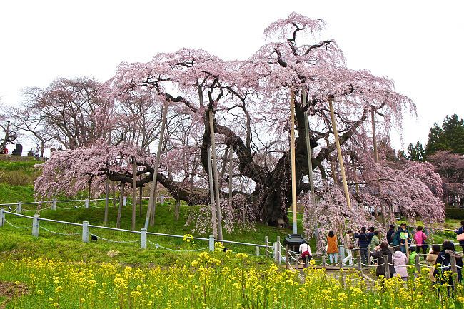 | ||
Weather 8°C, Wind W at 40 km/h, 55% Humidity Points of interest Miharu Takizakura, Miharudai Jingū Shrine, Tamurataigen Shrine, Joyama Park, Shinshoji | ||
Sliding in miharu fukushima
Miharu (三春町, Miharu-machi) is a town located in Tamura District, Fukushima Prefecture, in northern Honshū, Japan. As of December 2014, the town had an estimated population of 17,254 and a population density of 237 persons per km². The total area was 72.76 km².
Contents
- Sliding in miharu fukushima
- Map of Miharu Tamura District Fukushima Prefecture Japan
- Geography
- Neighboring municipalities
- History
- Economy
- Education
- Railway
- Highway
- International relations
- Local attractions
- References
Map of Miharu, Tamura District, Fukushima Prefecture, Japan
Geography
Miharu is located in north-central Fukushima prefecture.
Neighboring municipalities
History
The area of present-day Miharu was part of ancient Mutsu Province. During the Edo period the area formed Miharu Domain, a 50,000 koku han ruled by the Akita clan from 1645 until the Meiji Restoration. It was subsequently organized as part of Nakadōri region of Iwaki Province.
Miharu town was established with the formation of the municipalities system on April 1, 1889. On April 1, 1955, it annexed the neighboring villages of Ogisawa, Nakazuma, Nakago, Sawaishi and Kurita, all from Tamura District.
Economy
The economy of Miharu is primarily agricultural, with some chemical and light manufacturing.