
Department Ain Intercommunality Plaine de l'Ain Area 13.75 km² Local time Monday 12:56 PM | Canton Meximieux Time zone CET (UTC+1) Population 7,253 (2011) | |
 | ||
Weather 14°C, Wind N at 6 km/h, 62% Humidity | ||
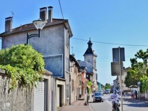
Meximieux is a commune in the Ain department in eastern France.
Contents
- Map of 01800 Meximieux France
- Geography
- History
- Population
- International relations
- Personalities
- Resistance
- References
Map of 01800 Meximieux, France
Geography
Located 35 km north east of Lyon and 10 km from Ambérieu-en-Bugey, the town is where the Dombes plateau meets the plain of the Ain River. Historically, Meximieux was part of the former province of Bresse. Over the centuries, its importance has developed from its location on the main route between Lyon and Geneva, and it now lies on the Autoroute 42 from Lyon.
History
Records of Meximieux date back to Roman times when it home to a small farming settlement called Maximiacus.
Population
Its inhabitants are known as Meximiards.
International relations
Meximieux has been twinned with German town of Denkendorf, Baden-Württemberg since 1986.
Personalities
The town was the birthplace of Claude Favre de Vaugelas, a 17th-century grammarian and man of letters.
Resistance
Meximieux is one of the 17 French cities to be awarded with the medal of resistance (Médaille de la Résistance). The French resistants of Meximieux fought with the allies in an outstanding collaboration with the U.S. army. This resulted in the victory against a German counter offensive on Meximieux the 1 and 2 September 1944. U.S. Army General, Michael S. Davison, became an honorary citizen of Meximieux.