
Founded 1968 | Population (2015) 344 | |
 | ||
Weather 16°C, Wind SW at 14 km/h, 54% Humidity | ||
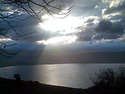
Mevo hama 10 06 2016 cloud ridging
Mevo Hama (Hebrew: מְבוֹא חַמָּה) is an Israeli settlement and kibbutz in the Israeli-occupied Golan Heights. The southernmost village in the Golan, it is located 2 kilometers (1.2 mi) from the Sea of Galilee at a height of 350 meters (1,150 ft) above sea level and falls under the jurisdiction of Golan Regional Council. In 2015 it had a population of 344.
Contents
Map of Mevo Hama
The international community considers Israeli settlements in the Golan Heights illegal under international law, but the Israeli government disputes this.
History
The second Israeli settlement established in the Golan after the 1967 Six-Day War, it was built on a Syrian military base called "Emrit Ez Edeen", from which the Syrians had fired at the kibbutzim on the border (Ein Gev and HaOn). In January 1968, several members of the surrounding kibbutzim gathered and decided to establish a new settlement in the area and in September had settled the ruins of the base. They were joined in 1971 by several youth groups from Israel, Australia and England. The name of the settlement, meaning The Gateway of, or Approach to, the Hot Springs, referring to nearby Hamat Gader, was given to it by author Mattityahu Shalem.