
Stations 14 | Opened September 6, 2015 | |
 | ||
Termini NAITHealth Sciences/Jubilee Operator(s) Edmonton Transit System | ||
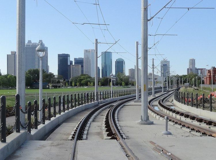
The Metro Line is a light rail transit line on the Edmonton LRT system, that operates from northwest Edmonton to southwest Edmonton scheduled to have begun operation by early 2014 but instead opened on September 6, 2015, at a reduced speed and frequency. The line uses 3.3 kilometres (2.1 mi) of new track, three new stations, and eleven stations on the existing Capital Line. The cost of the project is $665 million, jointly funded by the City of Edmonton, Province of Alberta, and the Government of Canada. It is the first new line that is not an extension of the existing line. The line is expected to add 13,200 riders per weekday. A trip from NAIT Station to Churchill is expected to take nine minutes. A number of roadworks are under construction or completed to revitalize the surrounding community. An extension to the northwest city limits has completed conceptual design, and a further extension is proposed through the city of St. Albert on Highway 2/St. Albert Trail.
Contents
History
In spring 2007, the funding for a concept plan and preliminary engineering was commissioned, and the City approved the plan the next year. In 2008, during construction of the Epcor Tower, the City ordered that the tunnel section below the tower be dug before the tower was completed, this saved $140 million from digging after the tower was built. The remainder of the tunnel, under Downtown Edmonton, was bored, and completed in November 2012. In 2009 the City approved the relocation of funds from the Gorman extension to the Metro Line, as the City felt northwest was a higher priority. In 2010 the City began preparation work, including utility relocation. The permanent closure of 105 Avenue between 102 Street and 105 Street was performed so MacEwan Station could be built. 105 Street was permanently closed to vehicular traffic between 107 Avenue and 108 Avenue to allow the line to continue along the existing road corridor, which alleviated the need to widen the corridor and remove some existing trees. 104 Street was closed between 108 Avenue and Kingsway in a similar fashion.
Testing began in July 2013, and the line began operation in September 2015 using an interim signalling system, with trains running at a frequency of 15 minutes, rather than 5. There have been three delays in beginning operations on the line: one from April to June 2014, one from June to December 2014, and another from December 2014 to February 2015. The delays have been caused by issues with the signalling system built by Thales. Thales gave control of the system to the City of Edmonton in March 2015, but failed to provide adequate documentation to place the line into service. The public plaza surrounding MacEwan Station, except for the area required to build Rogers Place, opened for use by people other than the construction crew in December 2014. In February 2017, trains were cleared to travel at 50 km/h.
Edmonton extension
An extension from the permanent NAIT station is in the planning phases by the City of Edmonton. The recommendation, released in May 2010, extends the Metro Line through the neighbourhood created by the dismantling of the City Centre (Blatchford Field) Airport, over Yellowhead Trail and the CN Railway yard, along 113A Street and 153 Avenue to the City of St. Albert limits. The extension would have eight stations, including stops in Blatchford (the neighbourhood created by the airport redevelopment), Rosslyn, Griesbach, Castle Downs, The Palisades, and at Campbell Road. As part of this extension, a park and ride is proposed at Campbell Rd and 153 Ave, along with a transit centre there, and two more transit centres are proposed at Castle Downs Station and Griesbach Station. This type of line is planned to run with less separation from other traffic, mostly with lower track speeds, no higher than general purpose traffic, still with traffic signal priority and dedicated lanes. This extension is 11 km long, and will have 8 new stations and a rebuilt NAIT station slightly to the west of its current location. This section of the line is not planned to use gate arms, bells and flashing lights as has been done with the Metro Line from NAIT to Churchill.
St. Albert extension
The City of St. Albert began studying extending Edmonton's LRT in early 2013, identifying four possible locations for stations. The City is looking at funding from all levels of government, 66% from Alberta GreenTRIP Fund and 8% from the City of St. Albert. On November 12, 2013, St. Albert council decided to continue studying LRT alignment options, but not to put any money into purchasing land or rail cars. The selected corridor was approved by St. Albert city council on December 2, 2014, which will run on St. Albert Trail and proposed four possible station locations. The line is proposed to be primarily aligned to the east of St. Albert Trail, reducing it to four lanes north of Hebert Road. As well, there are three new bridges proposed along the St. Albert extension to span Anthony Henday Drive, Sir Winston Churchill Avenue, and the Sturgeon River.
Stations
Future stations
The City of Edmonton approved the concept plan for a northwest LRT line, and nine stations, May 1, 2013.
Proposed stations
The City of St. Albert identified four possible locations for stations in early 2013. In October of 2015, the preferred location and alignment of the St. Albert extension was published in the Phase 2 report for the extension. Transit stations are proposed for the Downtown St. Albert, and the North St. Albert stations while park and ride services are only proposed for North St. Albert station.