
Country | Governor | |
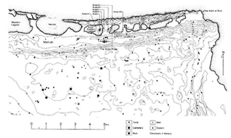 | ||
Map of Mersa Matruh
Mersa Matruh (Arabic: مرسى مطروح, [ˈmæɾsæ mɑtˤˈɾuːħ]) is a seaport in Egypt, the capital of the Matrouh Governorate. It is 240 km (150 mi) west of Alexandria and 222 km from Sallum, on the main highway from the Nile Delta to the Libyan border. Another highway leads south from the town, toward the Western Desert and the oases of Siwa and Bahariya.
Contents
During Ancient Egyptian times and during the reign of Alexander The Great, the city was known as Amunia. In Ptolemaic and Byzantine times it was known as Paraitonion (Παραιτόνιον), while in Roman times it was called Paraetonium.
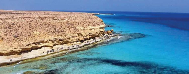
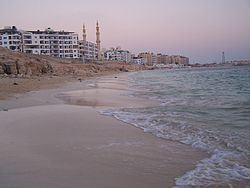
Marsa Matruh is a major tourist resort and serves as a getaway resort for Europeans as well as Cairenes. It is served by Marsa Matruh Airport. The city features soft white sand beaches and calm transparent waters; the bay is protected from the high seas by a series of rocks forming a natural breakwater, with a small opening to allow access for light vessels.
History
It started as a small fishing town during Ancient Egyptian times and the reign of Alexander The Great and was named Amunia. There are ruins of a temple of Ramesses II (1200 BC). Mersa Matruh became known as Paraitonion in the Ptolemaic era. When Roman occupation came to Egypt, the town became an important harbor for trade and shipping goods and crops to Rome. It was named Paraetonium by the Romans. During World War II, the British Army's Baggush Box was located to the east. Starting with the completion of an extension from the previous railhead at Fuka in February 1936, Marsa Matruh was the terminus for a single-track railway, which passed through El Alamein.
Climate
Marsa Matruh has a hot desert climate (BWh) according to Köppen climate classification, but blowing winds from the Mediterranean Sea greatly moderate the temperatures, typical to the Egypt's north coast, making its summers moderately hot and humid while its winters mild and moderately wet when sleet and hail are also common. Summers are sunny and dry, while in the colder months, mainly in winters, there is some rain and cloud cover.
Marsa Matruh and Port Said have the coolest summer days of any other cities or resorts, although not significantly cooler than other northern coastal places, additionally Rafah, Alexandria, Abu Qir, Rosetta, Baltim, Kafr el-Dawwar and Marsa Matruh are the wettest in Egypt.
The city has become a destination for millions of Egyptians and foreign tourists.
Another source shows more precipitation and stabler average temperatures.